









Annapurna Circuit with Tilicho Lake Trek – 12 Days Itinerary


Trip Facts


Complete Overview of the Tilicho Lake Annapurna Circuit Trek
Annapurna Circuit Trek with Tilicho Lake is a 12-day trek that is not just a trek but a beautiful journey full of adventure and natural views of forest, highway, and mountains. The best seasons for the Annapurna circuit trek are spring (March-May) and autumn (September-November), when the weather and views are clear and make the trek easier. Trekkers can experience adorable views, local food, villages, and the local culture.
Trekkers should prepare themselves physically for difficulties such as altitude sickness, injuries, breathing problems, and leg pain. They should also carry the required resources, which include a first aid kit, comfortable clothes, trekking shoes and boots, trekking poles, a sleeping bag or camping tent, snacks, and a water bottle.
The journey to the Annapurna Circuit Trek begins from Kathmandu to Besisahar by jeep, which takes around 3/4 hours. After this, trek begins from Dhara Pani (1,860 m / 6,102 feet) to Thorong La pass (5,416m/17,756 ft) with the amazing and beautiful view of Chame, Pissang, Manang, Hiking to Ganga Purna lakes, Shree kharka, Yak Kharka, Thorong Phedi and Mukti Nath temple (3,760 m / 12,623 ft) to Tilicho base camp. Similarly, you can go by jeep from Mukti Nath to Jomsom and Pokhara (850 m / 2,788 ft).
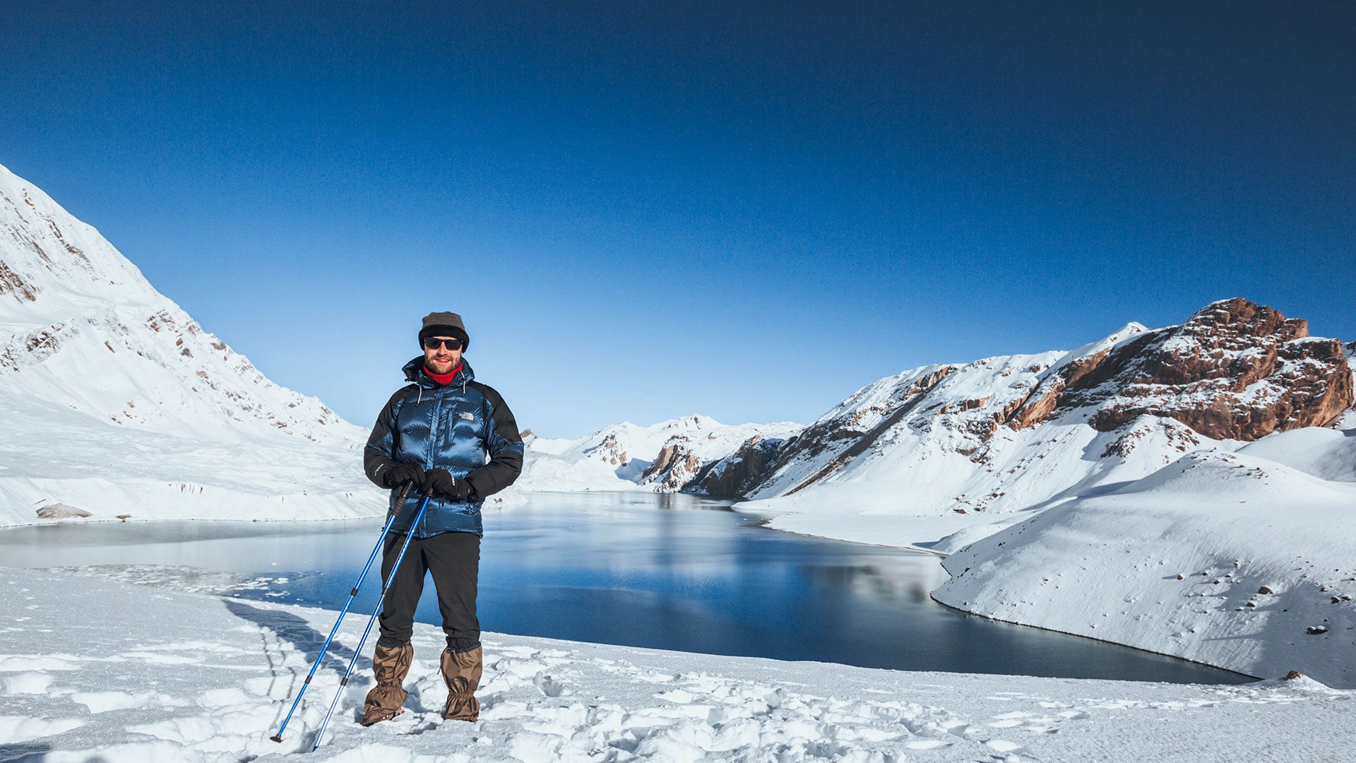
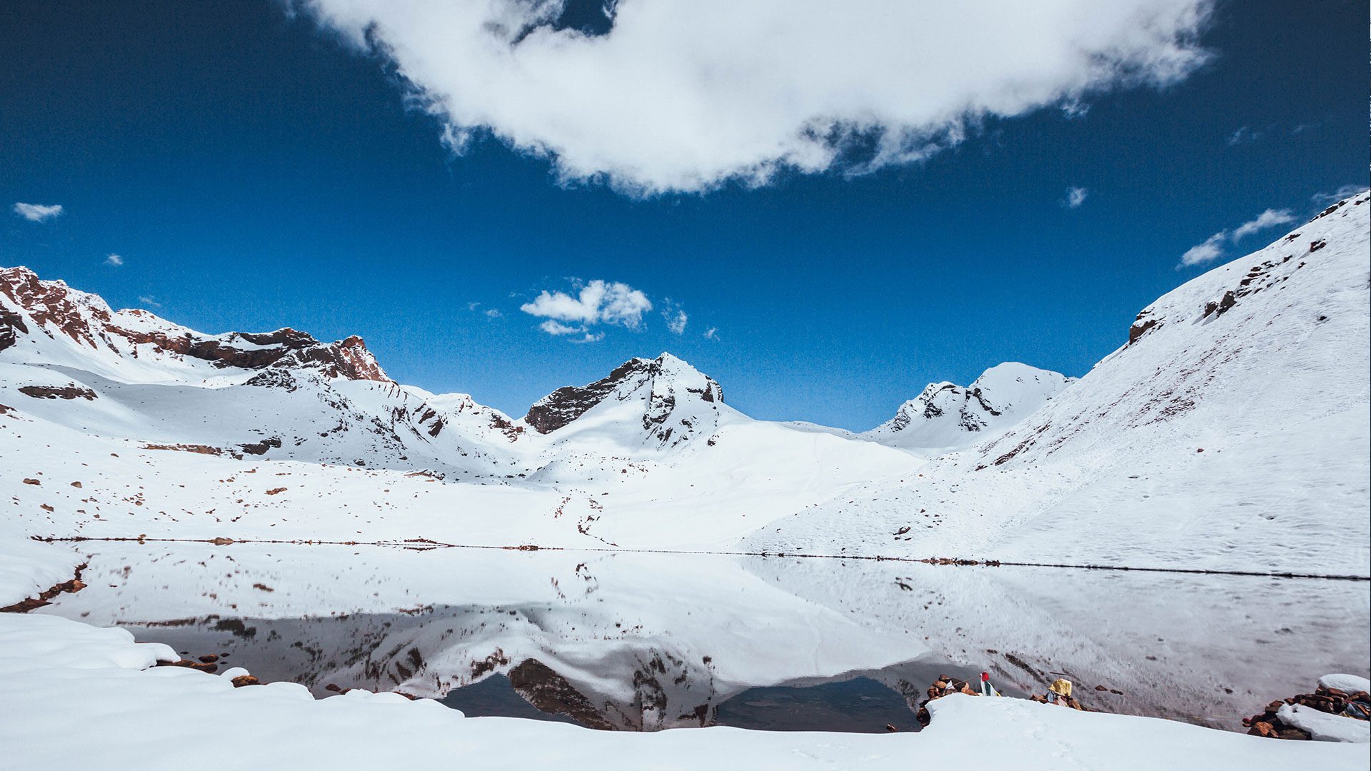
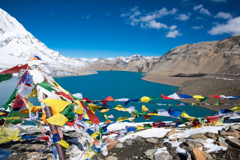
This major part of this trek is Tilicho Lake, which requires almost 2 days from Manang. This is a small trek to Tilicho Lake (4,920 m/16,141 ft), one of the world’s highest lakes. The trek to Tilicho Lake is difficult, but you can experience amazing views of mountains covered with snow. Before going to Tilicho Lake Base Camp (4,150m), you will spend a night in Tilicho Lake. This helps with climate adaptation. The blue lake surrounded by snowy mountains is an amazing view.
Trip Highlight
- Scenic drive from Kathmandu to Besisahar.
- Hike through forests and outstanding waterfalls, and explore the Marsyangdi River.
- Experience the culture of local Thakali foods and the culture of Magar and Gurung.
- Explore Manang with a stunning view of the mountains while acclimating at (3,535m/11600 ft)
- Witness the highest lake in the world, Tilicho Lake (4,920m/16,141 ft), with the scenario of the Annapurna mountains.
- Conquer Thorong la Pass (5,416m/17,756ft) with incredible views of snowy mountains in every possible direction.
- Visit Mukti-Nath temple, which has 108 taps and a naturally burning flame.
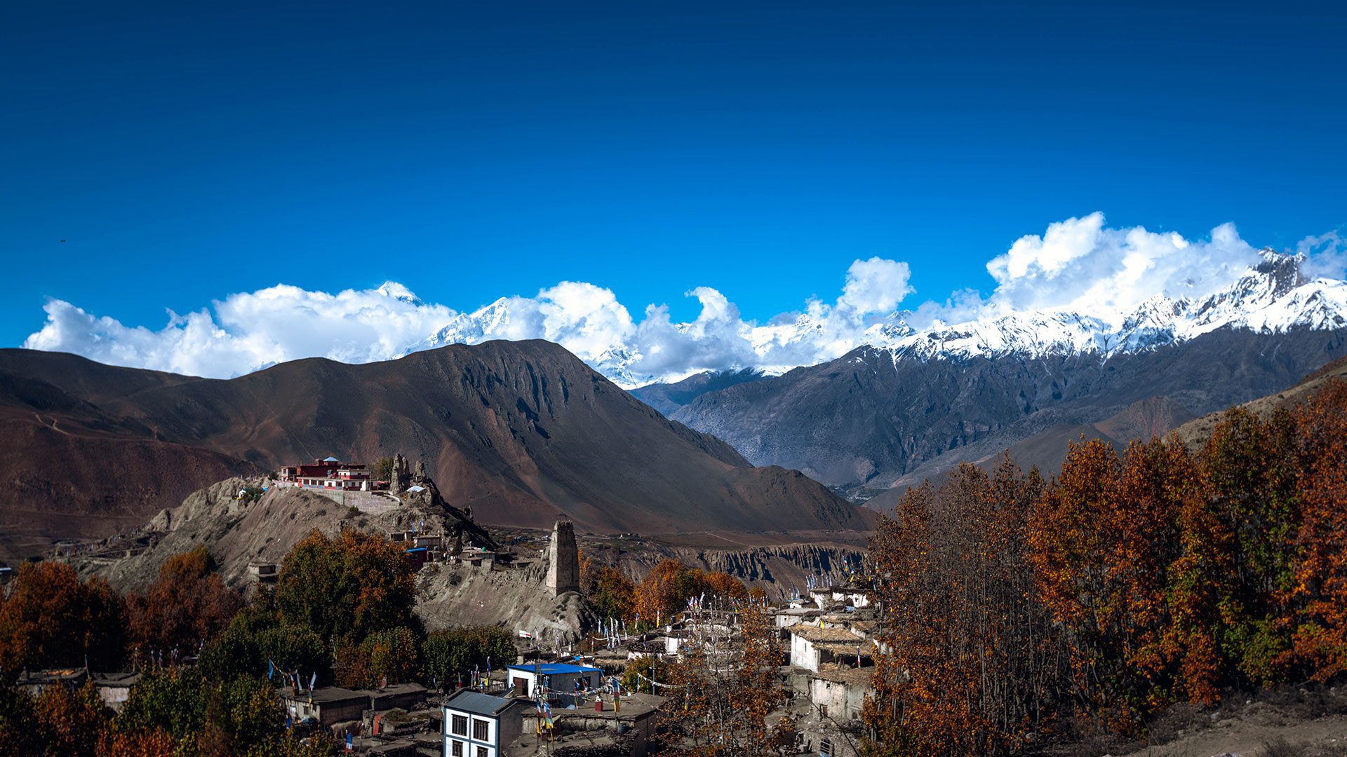
- Explore Marpha village, which is known for its Thakali culture and apple farms.
- Relax in natural hot baths in Tatopani.
- Marvel at Poon Hill and witness sunrise over the Annapurna peaks.
- Experience Himalayan griffons, sheep, and snow leopards.
- A cross suspension bridge connecting huge river valleys.
- Discover incredible views of Chame and Pisang.
Annapurna Circuit Trek with Tilicho Lake Detailed Itinerary
Your Journey, Step by Step
Dharapani to Chame (26m/10,826ft)
First real trekking day. The trail runs through Bhulbhule, Jagat, Chamje, and Tal, with small stops at each, each with a slightly different feel, though they blur together a bit by the end of the day. Forest cover switches between pine and rhododendron, with open sections where you can see across the gorge. A few suspension bridges to cross along the way.
You’ll notice the temperature drop as you climb, and the mountains start showing themselves properly between the ridgelines. There are a couple of waterfalls worth stopping for a good excuse for a break anyway.
Chame is the district headquarters for Manang, so it’s a step up in terms of facilities more guesthouses, a few shops, even a hot spring nearby if you’ve got the energy for it after 6-7 hours of walking. First real views of Annapurna II and Lamjung Himal from here.
- Max. Altitude: Chame (2,670 m / 8,760 ft)
- Duration: 6–7 hrs trek
- Overnight at a guesthouse
- Breakfast, lunch, and dinner included
Chame to Pissang (3300m/11,300ft)
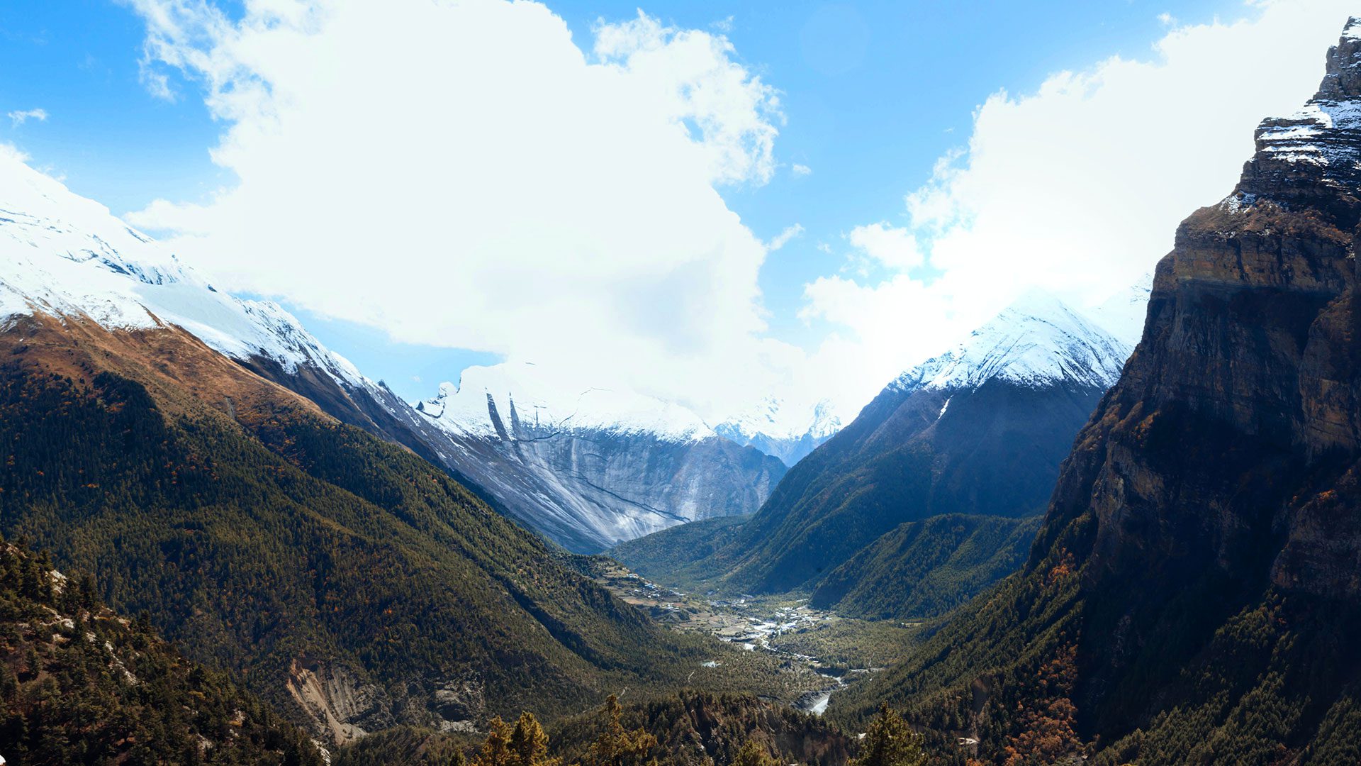
Steady climb today, and you’ll feel the air getting thinner. Cross the Marsyangdi on a suspension bridge, then it’s mostly pine forest with the trail running along the base of some genuinely huge granite cliffs.
The Paungda Danda rock face is the standout here, a curved granite wall that just rises straight out of the valley. Hard to capture in photos, worth seeing in person. As the trees thin out, Annapurna and the Pisang peaks come into view.
There’s a trail split near Pisang (upper and lower routes). Most groups take the lower path into the village itself. It’s a Tibetan-style settlement, stone houses, mani walls, and prayer wheels. Annapurna II sits right over the village, which makes for a good overnight stop.
- Max. Altitude: Pisang (3,300 m / 10,827 ft)
- Duration: 5–6 hrs trek
- Overnight at a guesthouse
- Breakfast, lunch and dinner included
Pisang to Manang (3535m/11600ft)
A short climb out of Pisang gets you to a hilltop with one of the better views so far, the whole Manang valley opens up with Annapurna behind it. After that, it eases off into pine forest, and then the landscape starts turning drier and more open as you get into the rain-shadow zone.
There are a few old monasteries along the way if you want to detour slightly, some genuinely old thangkas and statues inside, worth the extra 15-20 minutes. The terrain gets more arid and windswept as you close in on Manang, with good views of Gangapurna and Annapurna III.
Manang itself is one of the more interesting stops on the whole trek — tightly packed stone houses, flat roofs, narrow lanes, that old trading-post feel. You’ll be here two nights, which is a welcome change of pace.
- Max. Altitude: Manang (3,540 m / 11,614 ft)
- Duration: 5–6 hrs trek
- Overnight at a guesthouse
- Breakfast, lunch, and dinner included
Acclimatization Day, Manang
This is the main acclimatization stop on the trek, not really a full rest day, more of a “walk a bit higher, sleep low” setup, which is the standard way to handle altitude here.
Most people hike up toward Gangapurna Lake and the ridge above the village. The views from up there are genuinely worth the effort: Annapurna II, Annapurna III, Gangapurna, the glacier feeding the lake, and a good look back down the valley you just came up. There’s also Praken Gompa on the hillside if you’d rather do something shorter and quieter.
If you’d rather skip the hike, that’s fine too — Manang itself is worth wandering around, and there are a couple of bakeries where you can just sit and drink tea. Either way, the point of today is not to rush it. Staying hydrated matters more than it sounds like it should.
- Max. Altitude: Manang / Gangapurna viewpoint (approx. 3,950 m / 12,959 ft)
- Duration: 2–4 hrs, optional hike
- Overnight at a guesthouse
- Breakfast, lunch, and dinner included
Manang to Shree Kharka (4060m/13350ft)
This is where the trail splits off from the main circuit and heads toward Tilicho. You drop down to cross the Khangsar Khola, then climb back up to Khangsar village, sometimes called the last village on this side, and it does have that end-of-the-road feel to it.
Past Khangsar, the trail opens up and becomes more exposed, with Annapurna and the Chulu peaks visible for most of the walk. Narrows in a few spots with a decent drop below, nothing technical, but pay attention to your footing.
Shree Kharka is little more than a handful of guesthouses set below some fairly imposing peaks. If you’ve got energy left in the evening, a short walk around the valley catches decent light on the mountains.
- Max. Altitude: Shree Kharka (4,080 m / 13,386 ft)
- Duration: 4–5 hrs trek
- Overnight at a guesthouse
- Breakfast, lunch, and dinner included
Shree Kharka to Tilicho Base Camp (4,150m/13,615ft)
One of the tougher days, mostly because of how exposed the trail is rather than the distance itself. About half an hour out of Shree Kharka, you cross a suspension bridge that’s roughly the halfway mark to base camp.
After the bridge, the trail gets more serious: long stretches of loose scree, and this section does see occasional rockfall, so your guide will usually want to move through it without too many stops. The scenery is stark bare, wind-scoured slopes with the Annapurna range in the background.
Base camp itself is a small cluster of guesthouses tucked under the mountains. Not much to do here in the evening besides rest up — tomorrow’s the big day.
- Max. Altitude: Tilicho Base Camp (4,150 m / 13,615 ft)
- Duration: 6–7 hrs trek
- Overnight at a guesthouse
- Breakfast, lunch, and dinner included
Tilicho Base Camp – Tilicho Lake – back to Tilicho Base Camp (4,920m)
Early start today, and it needs to be early, the trail to the lake crosses open ground that gets windy fast once the sun’s up, so beating the wind matters more than beating the crowds.
It’s a steady, fairly demanding climb from base camp, mostly rocky, high-alpine terrain. Tilicho Lake shows up pretty suddenly once you crest the final ridge a long stretch of blue-turquoise water, close to 4km end to end, sitting in a bowl of ice and rock with Tilicho Peak, Nilgiri, and the Annapurna range around it. At 4,920m, it’s usually cited as one of the highest lakes of its size anywhere.
Take your time at the top; most people spend 30-45 minutes here before heading back. It’s the same route down, same exposed sections, so no shortcuts on caution just because you’re tired. You’ll return to Tilicho Base Camp for the night.
- Max. Altitude: Tilicho Lake (4,920 m / 16,141 ft); return to Tilicho Base Camp (4,150 m / 13,615 ft)
- Duration: 6–7 hrs trek
- Overnight at a guesthouse
- Breakfast, lunch, and dinner included
Shree Kharka to Yak Kharka (4,050m/13,287ft)
A gentler day, which is welcome after yesterday. The trail rejoins the main circuit, dropping back through Shree Kharka and then across open alpine pasture. You’ll likely see yaks and horses grazing along the way.
It’s a mix of meadow, rocky ground, and the odd stream crossing. Vegetation keeps thinning out, which is a fairly obvious sign you’re getting close to Thorong La territory now.
Yak Kharka is a small handful of lodges in a wide, open valley. Good spot to get some extra sleep before the next two days, which are the hardest of the trek.
- Max. Altitude: Yak Kharka (4,050 m / 13,287 ft)
- Duration: 3–4 hrs trek
- Overnight at a guesthouse
- Breakfast, lunch and dinner included
Yak Kharka to Thorong Phedi (4,525m/14,525ft)
Shorter day on paper, but don’t let that fool you, the altitude and the wind make it feel harder than the distance suggests. The trail climbs steadily along the exposed hillside, and afternoons here tend to be windy, so an earlier start helps.
Loose, rocky ground in places, and a couple of spots prone to rockfall, where your guide will likely keep the group moving rather than stopping. Not many places to rest along the way, so carry enough water and snacks before you set off.
“Phedi” just means “foot of the hill,” and that’s exactly what this is, sitting right at the base of the Thorong La climb. Guesthouses are basic here. Most people turn in early, since tomorrow starts before sunrise.
- Max. Altitude: Thorong Phedi (4,525 m / 14,846 ft)
- Duration: 4–5 hrs trek
- Overnight at a guesthouse
- Breakfast, lunch, and dinner included
Thorong Phedi to Muktinath Temple (3,760m/12,623ft) via Thorong La Pass (5,416 m / 17,769 ft)
The big day. You’re up around 4 or 5 am, climbing from Thorong Phedi past High Camp and on toward the pass. The goal is to be over the top before the wind picks up, which it usually does by mid-morning.
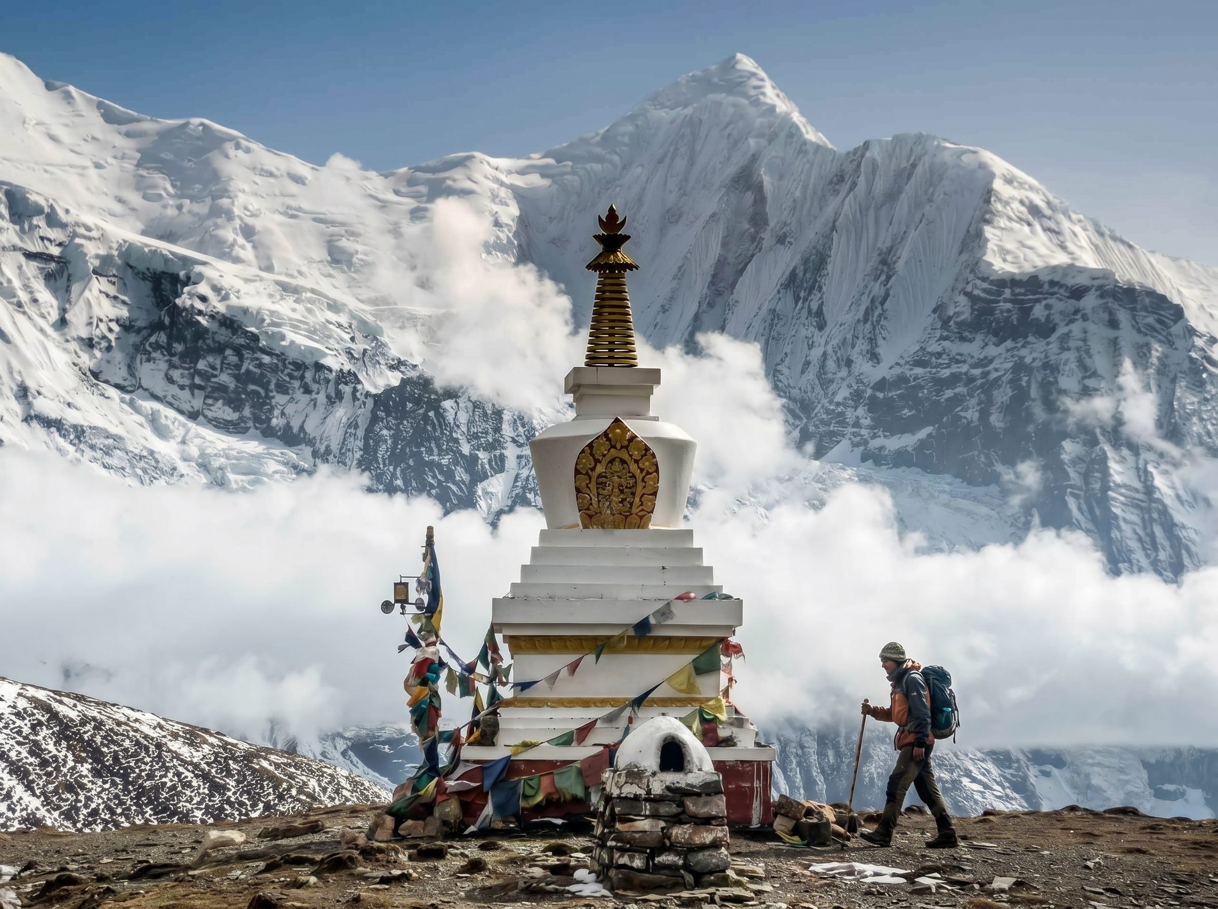
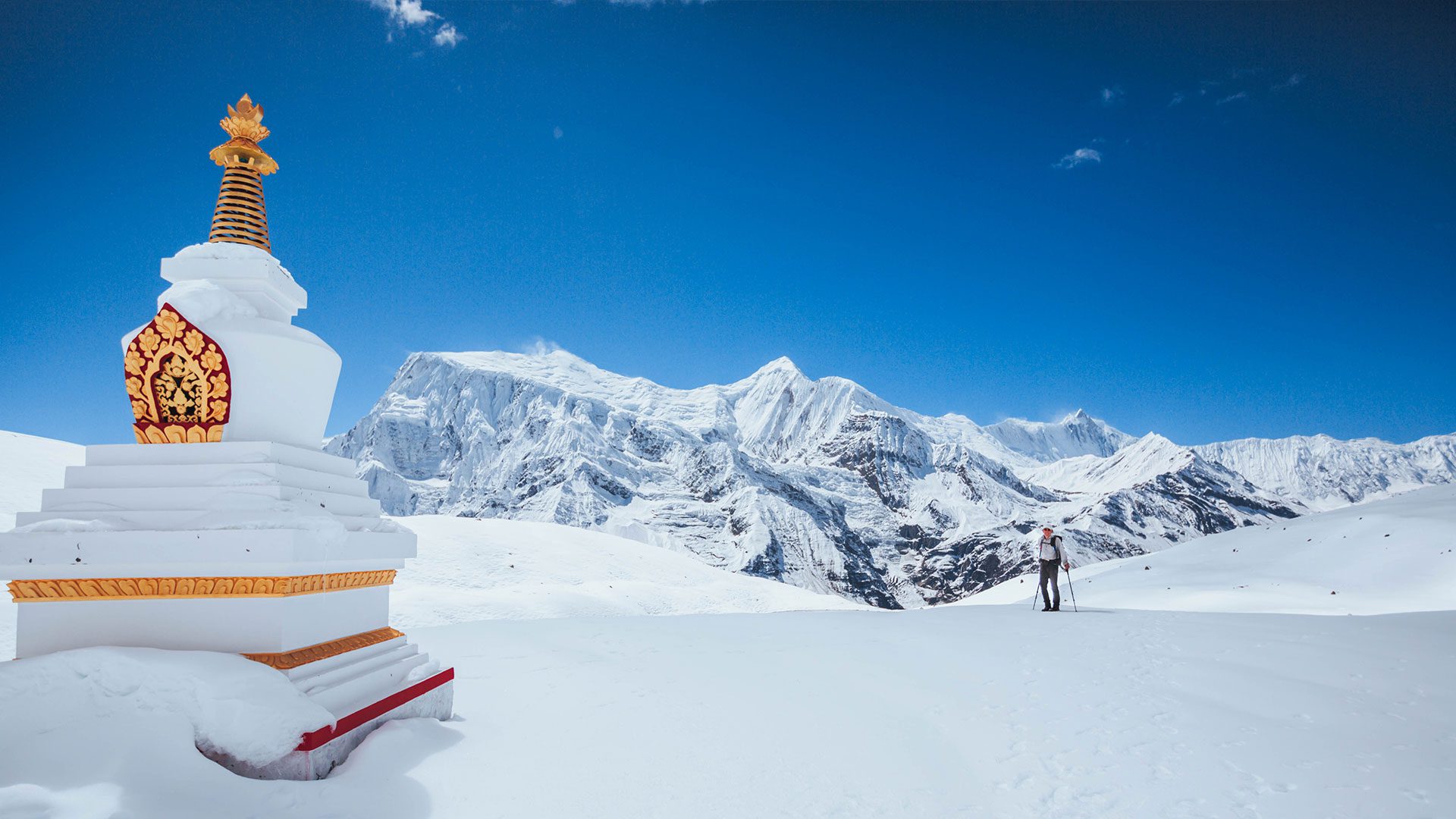
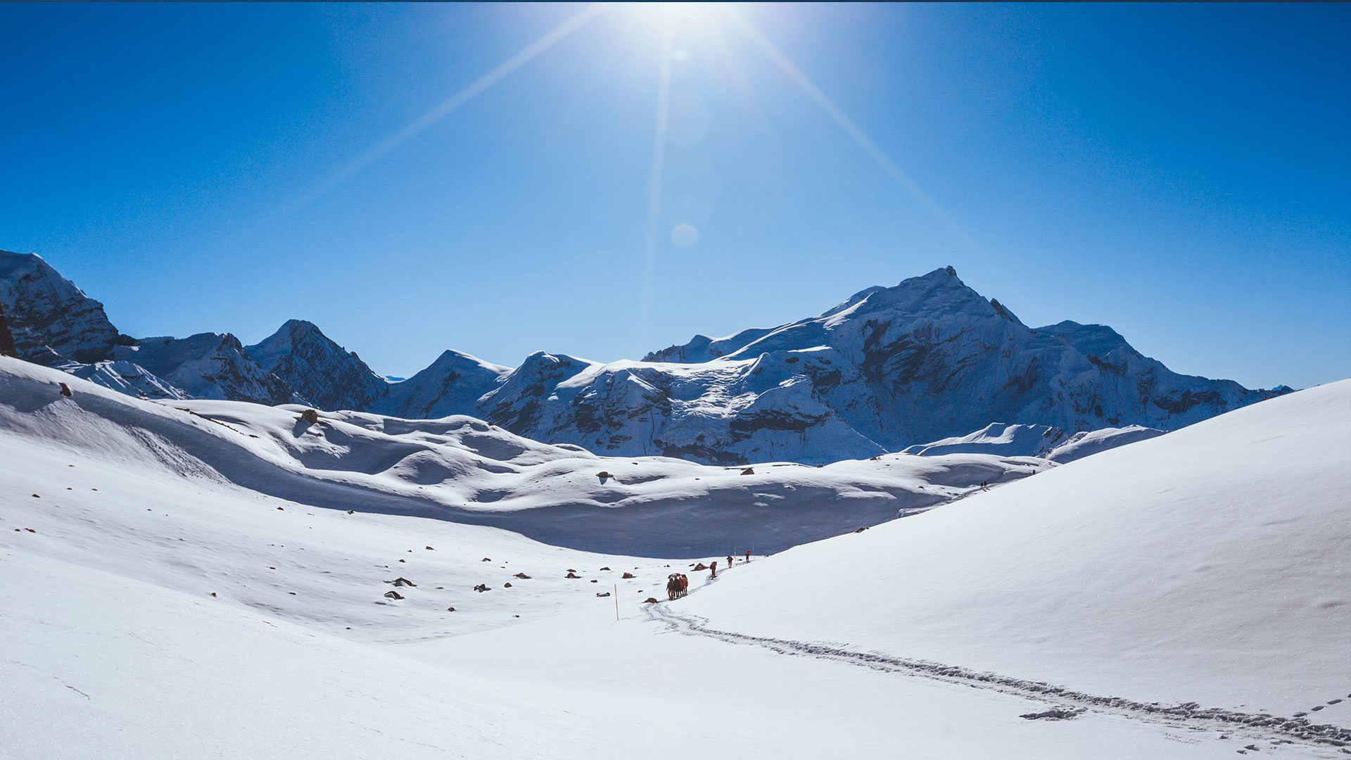
Thorong La sits at 5,416m, one of the highest trekking passes anywhere in the world, and the climb up is slow going simply because there’s less oxygen to work with. Thorong Peak, Khatung Kang, Chulu West, and Chulu East are all visible around you, along with a lot of open, barren high-altitude terrain. The top of the pass is marked with prayer flags and stone chortens. Most people stop here for a while, take photos, catch their breath, and look out over both the Manang and Mustang sides.
From there, it’s a steep descent through dry, almost lunar terrain that gradually turns into the Mustang-style desert landscape as you drop. You’ll pass through Charabu on the way down to Muktinath, a pilgrimage site for both Hindus and Buddhists, known for its 108 water spouts and an eternal flame that’s apparently been burning for a very long time. It’s a long day, and reaching Muktinath tends to feel like a proper milestone.
- Max. Altitude: Thorong La Pass (5,416 m / 17,769 ft); Muktinath (3,760 m / 12,336 ft)
- Duration: 8–9 hrs trek
- Overnight at a guesthouse
- Breakfast, lunch and dinner included
Drive from Muktinath to Jomsom(2720m/8924ft) continue to Pokhara (850m/2788ft)
Morning’s free to visit Muktinath Temple before you head off worth doing regardless of your own beliefs, given how significant the site is. Then it’s a drive down to Jomsom, through the dry Mustang valley with Nilgiri and Dhaulagiri visible for much of the ride.
From Jomsom, the road follows the Kali Gandaki, one of the deepest gorges anywhere, through villages like Marpha (apple orchards, whitewashed houses) and Tatopani, which has natural hot springs if there’s time to stop.
The landscape changes fast on this drive: dry Mustang terrain gives way to green hills and terraced farmland as you drop toward Pokhara. Arriving lakeside, with Annapurna reflected in Phewa Lake, is a pretty good way to end the trek.
From here, you’re free to do what you want: walk the lakeside, get a proper meal somewhere, or just sit and let the last two weeks sink in. Onward travel to Kathmandu (by road or flight) can be arranged separately.
- <li”list-style-type: none;”>
- Max. Altitude: Jomsom (2,720 m / 8,923 ft); Pokhara (820 m / 2,690 ft)
- Duration: 5–6 hrs drive
- Overnight at a hotel
- Breakfast included
Customize this trip with help from our local travel specialist that matches your Interests.
Customize This TripAnnapurna Circuit Trek with Tilicho Lake Inclusions
What’s Covered in Your Adventure
- Kathmandu to Besisahar by local bus.
- Besisahar to Dharapani by sharing a jeep.
- The best available private lodge during the trek.
- Meals/breakfast/lunch and dinner.
- One highly experienced and friendly guide with their expenses.
- Strong, helpful sherpa potter with safe food, sleep, insurance, and Gear (one potter for two people).
- Duffle bag for trekking (if you need). Trekking map and trip (achievement certificate).
- All the necessary trekking permits.
- First aid medicine kit.
- Government taxes and office service.
- One night accommodation in Pokhara with breakfast.
- One night accommodation in Kathmandu with breakfast.
- Muktinath to Pokhara by sharing a jeep.
- Pokhara to Kathmandu tourist (if needed).
- Meals not specified in Kathmandu and Pokhara.
- Travel and Health Insurance
- International airfare
- Cost of Nepal entry visa
- Soft drinks, including mineral water Snacks and other personal expenses
- Hot showers, phone Charging, Internet, etc.
- Expenses during the trek
- Personal trekking equipment
- Tips for trekking guide
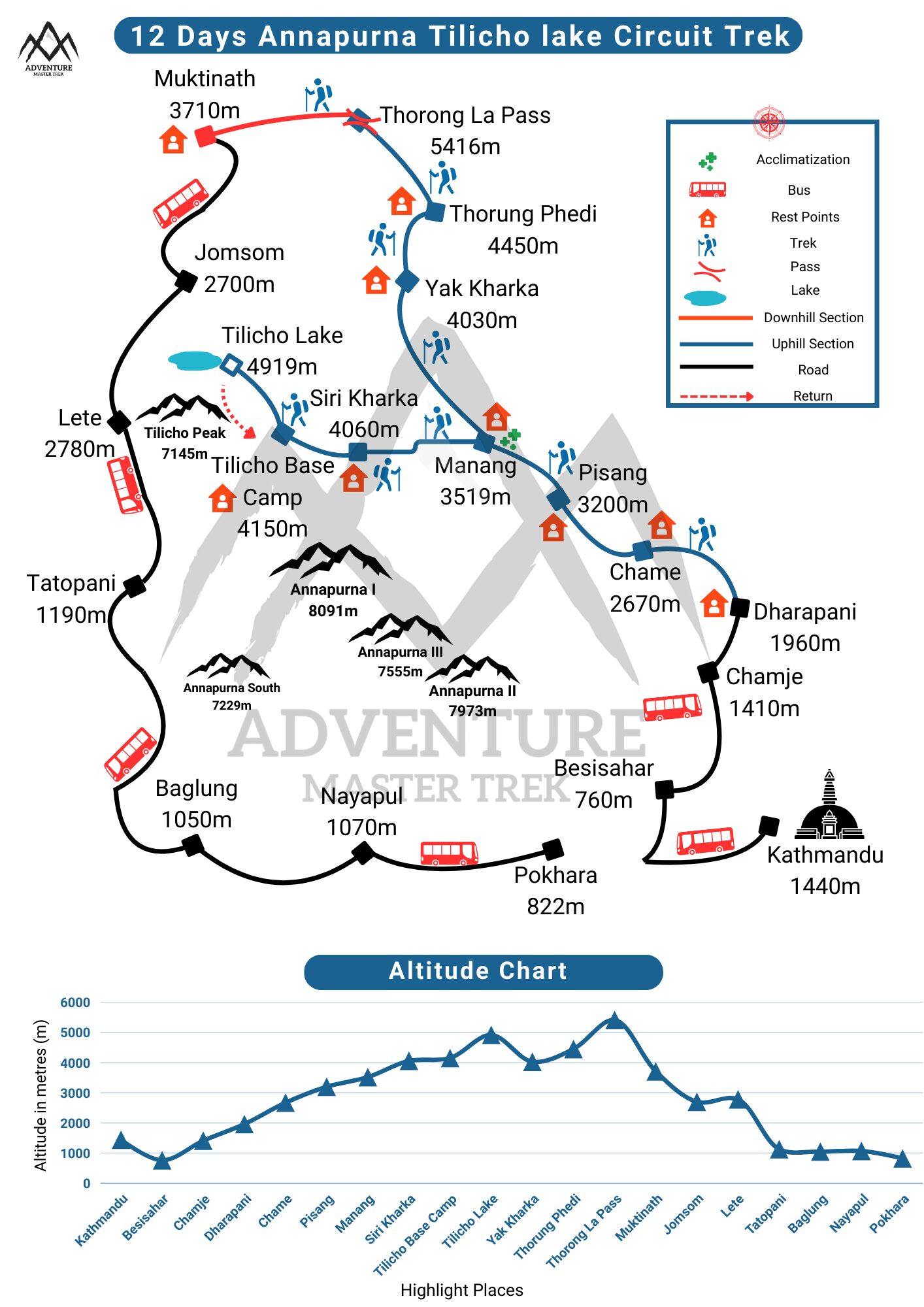
Annapurna Circuit Trek with Tilicho Lake Maps
Navigate Your Journey
Useful Information for Annapurna Circuit Trek with Tilicho Lake
Know Before You Go
Accommodation and Food on the Annapurna Circuit Trek
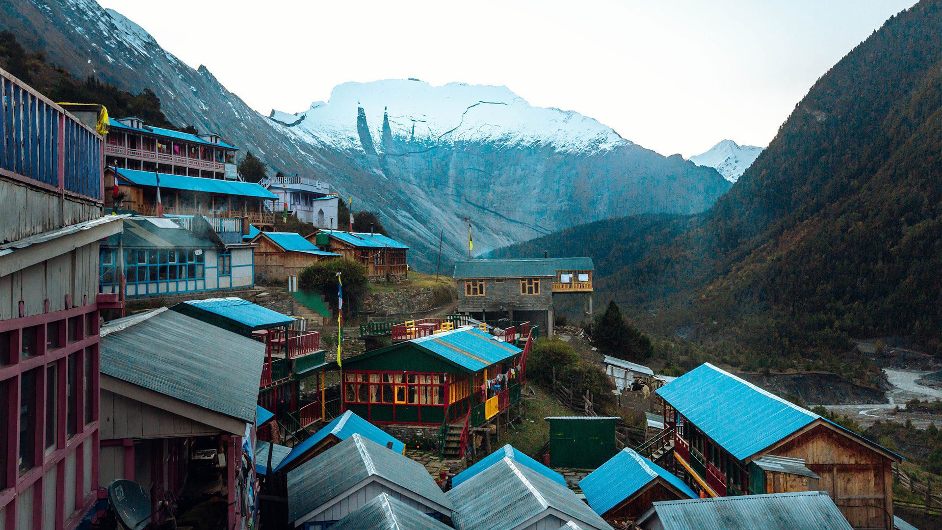
The primary accommodation is lodges and tea houses, which are run by local people. Here, you can get simple but comfortable lodges costing according to the place and altitude. You can get single-bed rooms, double-bed rooms, or even dormitory rooms. If you are staying in a lower altitude location, then you will get better lodges with electricity, wi-fi, and water facilities. However, at higher altitudes, lodging offers fewer facilities and limited services and resources.
Teahouses and lodges sell a variety of foods, especially Nepali, Tibetan, and basic Western food. The most popular meal is “Dal Bhat and Tarkari”, a highly recommended comfort dish by guides that also makes trekkers more energetic. Some other dishes like momos, Thukpa, pasta, Chowmein, etc, are also served. But as you trek to higher altitudes, the variety of dishes decreases, as food options are limited because supplies are difficult to obtain. As a result, the food becomes more expensive.
Accommodation along the Annapurna Circuit is primarily in teahouses and lodges, where basic shared rooms are available for USD 5–8 per night and private rooms range from USD 10–15 per night depending on the location and season. For those seeking more comfort, there are two notable luxury accommodation options along the trail in Manang and Muktinath, which offer superior facilities and amenities at an additional cost of around USD 40 per night. Food costs approximately USD 20–35 per day, with local meals like dal bhat, noodle soup, and tsampa being the most affordable options, while Western-style dishes, bakery items, and specialty foods cost noticeably more at higher elevations. Tea, coffee, and hot drinks are available for USD 1–3 per item at lower altitudes but tend to increase in price as you climb higher, and bottled water ranges from USD 1–3 per liter, making a reusable bottle with purification tablets a cost-effective alternative. Overall, trekkers can expect to budget approximately USD 30–55 per day covering accommodation, meals, and drinks, though those opting for private rooms or the luxury lodges in Manang and Muktinath should plan for a higher daily expenditure.
Safe Drinking Water on the Annapurna Circuit Trek
You can get drinking water from different sources, such as teahouses and water taps. You should avoid dirty and polluted tap and river water because it can cause infections. The best options for drinking water are mineral water bottles and filtered water. Most of the tea houses sell hot water, which is safe and helps to keep the body warm. You can carry water purification tablets or portable water filters. At high altitudes, water bottles are more expensive because of a lack of transportation. To decrease plastic wastage, carry your water bottles because you need to stay hydrated at higher altitudes, and to avoid dehydration.
Buying water bottles starts from as little as 50 cents to USD 1 at lower elevations, rising in price as you gain altitude.
Electricity and Internet on the Annapurna Circuit Trek: Charging, Wi‑Fi & Mobile Coverage
Electricity is accessible throughout the Annapurna Circuit and Tilicho Lake route to the point that it is reliable and expensive, depending on altitude and remoteness. Teahouses in lower parts, such as Besisahar, Dharapani, Chame, and at other times to as far as Manang tend to be available in rooms or other common places. This power is normally provided by the national grid or local hydro power.
On the way up to higher areas like Pisang, Manang, and Yak Kharka, and closer to Thorong La Pass, electricity is no longer as dependable and is generally solar-powered. Power failures may result from weather, reduced production, or technical problems, and the charging points may not be in rooms but in the general eating hall. In most lodges, a charging fee is applied, usually between 1 and 3 USD per device or per hour of charging.
Portable solar chargers and power banks are also highly recommended because cold conditions drain batteries more quickly, and the power supply might be insufficient or congested during the most popular seasons. Wi-Fi is also common in teahouses, especially in larger villages, but it is slow, intermittent, and generally device-based in the higher areas.
| Location Segment | NTC Mobile Coverage | Ncell Coverage | Wi‑Fi Availability |
| Besisahar → Chame | Strong | Strong | Common, often free or low-cost |
| Pisang → Manang | Moderate | Moderate | Available, slower, sometimes paid |
| Above Manang → Tilicho / Thorong La | Patchy | Patchy | Available at some teahouses for a fee |
| Muktinath → Jomsom | Moderate | Moderate | Better access in towns |
Transportation for the Annapurna Circuit Trek
1. Kathmandu to Besisahar
This is the first road journey of the trek, connecting Kathmandu to the trailhead of the Annapurna Circuit. Travelers can choose between a local bus or a private jeep depending on budget and comfort. A local bus departs at 6:00–7:00 AM from Gongabu Bus Park, taking 5–6 hours at a cost of USD 8–10 per person, offering views of Nepal’s mid-hills and river valleys though seating is basic and roads can be bumpy. A private jeep covers the same route in 4–5 hours at a cost of USD 150–170 for up to 6 people, offering greater flexibility and comfort. Plan for a breakfast stop at Malekhu Bazar around 2 hours into the journey, and a lunch stop at Dumre Bazar approximately halfway, both well-known spots with good local food options including fresh fish and hearty dal bhat.
2. Besisahar to Dharapani
This leg travels through the Marsyangdi Valley and is one of the more dramatic road sections of the entire journey. A local sharing jeep accommodating up to 10 people covers the route in 4–5 hours at a cost of USD 20–25 per person, passing through stunning gorges, waterfalls, and traditional villages. A private jeep is available at USD 180–200 for up to 6 people, offering more space and the freedom to stop at scenic points along the way. The roads are largely unpaved and rough in sections, so some degree of discomfort is expected regardless of vehicle choice.
3. Muktinath to Pokhara
After crossing Thorong La Pass and descending to Muktinath, trekkers have several options to return to Pokhara. A shared jeep from Muktinath to Jomsom takes about 1–1.5 hours at USD 10–15 per person, from where a scenic mountain flight to Pokhara takes just 20–25 minutes at USD 80–100 per person, offering breathtaking aerial views of the Annapurna and Dhaulagiri ranges. Alternatively, a direct private jeep from Muktinath to Pokhara takes 7–8 hours along the Kali Gandaki Valley at a cost of USD 250–300 for up to 6 people, while a local bus from Jomsom to Pokhara takes 8–9 hours at USD 15–20 per person, passing through Tatopani and Beni along a scenic but winding mountain road.
Flight information
The international flights arrive at Tribhuvan International Airport, where transportation by air starts and ends at the Annapurna Circuit trailhead. Numerous trekkers come to Kathmandu by tourist bus or local jeep to the trail head at Besisahar or Dharapani. The average price of a tourist bus ranges from 10-30 USD per person, and a jeep with more vehicles costs 150-200 USD, depending on the type of vehicle and the time of year. If returning via Pokhara, you can fly from Jomsom to Pokhara at approximately USD 75-120, or take a jeep/bus for USD 15-30. These means of ground transportation are vital to consider in your trek plans, as they influence time and cost and are highly prevalent among trekkers on the Annapurna Circuit.
1. Jomsom to Pokhara Flight
The flight from Jomsom to Pokhara is one of the most scenic short-haul mountain flights in Nepal, covering the distance in just 20–25 minutes at a cost of USD 80–100 per person. The route passes through the dramatic Kali Gandaki Gorge, the world’s deepest gorge, offering stunning aerial views of Dhaulagiri, Annapurna, and Nilgiri rising sharply on either side. Early morning flights are strongly recommended as strong afternoon winds in the Mustang region frequently cause delays and cancellations, making the 6:00–8:00 AM departure window the most reliable. There are a couple of scheduled flights operating daily, so booking in advance is advisable especially during peak trekking season.
2. Pokhara to Kathmandu Flight
The flight from Pokhara to Kathmandu takes approximately 25–30 minutes and departs multiple times every hour throughout the day, making it a highly convenient option compared to the 6–7 hour bus journey. The cost is USD 90–100 per person and the flight offers magnificent views of the Annapurna and Manaslu ranges on clear days, with Machapuchare (Fishtail Mountain) particularly striking from the air. Morning flights generally offer the clearest visibility and the most spectacular mountain views.
3. Recommended Activities in Pokhara
Pokhara is Nepal’s adventure capital and offers a range of thrilling activities perfect for celebrating the completion of the Annapurna Circuit. Paragliding over Phewa Lake and the Pokhara valley costs USD 70 per person and is one of the most popular and unforgettable experiences in the region, offering sweeping views of the Annapurna range from the air. Bungee jumping is available at USD 80 per person for those seeking an extra adrenaline rush, while a hot air balloon ride over the Pokhara valley at sunrise costs USD 145 per person and provides a serene and breathtaking perspective of the Himalayas. For water lovers, a one-day white water rafting trip on the Seti or Kali Gandaki River costs USD 40 per person and is a fantastic way to experience Nepal’s wild rivers and lush gorge scenery.
Recommended Group Size for Annapurna Circuit Trek
The best group size for the Annapurna Circuit Trek differs according to expertise level and personal interests. Trekking groups range from 2 to 15 people in one group. For a balanced journey, it is better to have 6 to 12 people in one group. However, smaller groups may cost a higher price per person, such as guide charge, porter, meals, and other expenses. The group size for Annapurna Circuit Trek depends on trekkers’ choice requirements on costs and comforts.
Annapurna Circuit Trek Difficulty: How Challenging Is It?
The Annapurna Trek is considered a beginner-to-moderate trek, and as such, first-time trekkers, families, and travelers with limited trekking experience can do it. Although the altitude is not as high as in other Himalayan treks that span longer distances, the path is still associated with the daily uphill, stone staircases, and moderate ups and downs that may be physically challenging. Realizing the challenge of the trek can assist the traveler to get mentally and physically ready to make the most out of it and have the least risks.
Physical Demands
Physically, the expedition requires moderate physical strength. An average walking day of the trekkers is 456 hours every day, where an average person covers a distance of 7-13 kilometres and gains at an altitude of 500-1280 meters/day. Some of the passages, especially the one where Ulleri to Ghorepani occurs, contain extended stone steps, which test the ability of legs and heart. Although the speed is not too fast, constant walking and climbing may wear down novices, particularly those who are not accustomed to trekking at elevation.
The pay of this physiological being is on the spot. The ascents are accompanied by mountain panoramas, tropical forests of rhododendron, and classic villages, which are stimulating and refreshing to the mind. In order to cope with the physical conditions, the trekkers are encouraged to walk steadily, take frequent short breaks, and use the trekking poles to avoid pressure on the knees and joints.
The exercises, such as walking on a weighted backpack, stair climbing, and exercises to make the legs stronger, are pre-trek exercises that go a long way to enhance endurance on such day-to-day hikes.
Altitude Considerations
The Annapurna Panorama Trek is said not to be a high-altitude risk, but there are areas that experience altitude effects, such as Ghorepani (2,850 meters) and Poon Hill (3,210 meters), among others, which could experience minor effects on altitude-sensitive persons. The symptoms may consist of headache that will be mild headache, fatigue, or difficulty breathing during climbs.
Slow ascents, hydration, and paying attention to your body are the keys to controlling the altitude. Pacing oneself in hilly areas and not overworking can minimize the chances of being uncomfortable. Diamox is also used by some trekkers to prevent altitude sickness; however, most people just need to pace, take a rest, and acclimatize. Its relatively lower altitudes and stays in villages overnight, make this trek much easier to cope with as compared to other higher Himalayan treks, which is why the trek is ideal for those who are new to the field or a family.
Trail Conditions
The conditions of the trail are different with the seasons. The trekking path is mostly paved with stones, with tea houses, although it includes uneven surfaces, slippery stones and narrow ridges. Trails are also usually good in spring and fall, and there are very few obstacles in the monsoon season; there are slippery trails, mud and swollen streams. During winter, there may be ice patches, particularly on the ascent to Poon Hill in the early mornings.
These trail challenges can be overcome by the use of firm waterproof trekking boots, trekking poles and layered clothing by the travelers. Proper shoes will keep you on the ground on rocky and gravel trails, poles will ease the load on the knees on steep slopes, and multi-layered clothing will keep you warm in varying weather. Hiking slowly and taking the routes that are highly maintained to tea houses makes even the most difficult parts solvable by most trekkers.
How to Prepare for the Annapurna Circuit Trek
To get the most out of the Annapurna Circuit Trek and handle the physical and mental challenges, as well as the high altitude, it is necessary to prepare properly. This is a training on fitness, equipment organization, acclimatization, and psychological preparations so that the journey will be safe and fulfilling.
Physical Preparation
The expedition entails long days of walking, hard ups and downs, and the unpredictable nature of the ground; thus, it is essential to build stamina and strength. Of particular importance is cardiovascular fitness, as your body must effectively utilize oxygen at elevated altitudes. Long-distance hiking, brisk walking, running, cycling, and stair climbing are recommended. Balance and stability on unstable trails will be enhanced through strength training that emphasizes the legs, core, and back, such as squats, lunges, planks, and weighted exercises.
It is also good to train for trekking with a full backpack and gradually add weight to the pack to approximate real conditions. This will train your muscles, joints, and endurance in days of constant walking with loads. Stretching and yoga are among the flexibility exercises that will help avert injuries and enhance overall mobility on rocky or steep trails.
Mental Preparation
Mental fitness is equally significant as physical fitness in the Annapurna Circuit. Remote areas, long days, high altitudes, and erratic weather may be psychological. Mental preparation involves setting realistic expectations, scheduling days of rest, and imagining difficult places like Thorong La Pass. One can also cultivate a positive attitude, remain flexible, and practice mindfulness or meditation to manage stress, fatigue, and discomfort.
They should also get used to the trail, weather conditions, and the effects of the altitude before they begin trekking. Knowing the possible obstacles, how to react to fatigue, or light altitude sickness, and having a mental preparation makes it easier.
Altitude Sickness on Annapurna Circuit Trek with Tilicho Lake (12 Days)
Altitude sickness (Acute Mountain Sickness or AMS) is a significant concern on the Annapurna Circuit Trek with Tilicho Lake because the route ascends rapidly from low river valleys to extreme elevations above 5,000 meters. The highest points include Thorong La Pass (5,416m) and Tilicho Lake (4,919m), making acclimatization essential even for well-prepared trekkers.
Symptoms of Altitude Sickness
Symptoms typically appear within 6–24 hours after gaining altitude:
- Persistent headache
- Nausea or vomiting
- Loss of appetite
- Dizziness or lightheadedness
- Unusual fatigue or weakness
- Shortness of breath during mild activity
- Difficulty sleeping
In more serious cases:
- Severe headache that does not improve
- Confusion or slow thinking
- Loss of balance or coordination
- Chest tightness or persistent cough
- Extreme breathlessness even at rest
Prevention of Altitude Sickness
Preventing AMS on this trek requires careful pacing and discipline:
- Ascend gradually and avoid rushing the itinerary
- Include proper acclimatization stops such as Manang (3,500m+)
- Hydrate consistently throughout the day
- Avoid alcohol and smoking during the trek
- Eat light, high-energy meals
- Walk at a steady pace and avoid overexertion
- Follow “climb high, sleep low” where possible
- Keep warm to reduce fatigue and energy loss at altitude
How to Deal With Altitude Sickness
If symptoms appear, immediate response is critical:
- Stop ascending and rest at the same altitude
- Drink water slowly and maintain hydration
- Avoid further physical exertion
- Descend immediately if symptoms worsen
- Inform your guide or trekking team right away
- Use prescribed medication like acetazolamide if advised
- Seek emergency evacuation in severe cases
Permits for the Annapurna Circuit Trek | Cost
To complete the Annapurna circuit trek with Tilicho Lake, you must have the following permits:
- Annapurna Conservation Area permit(ACAP): This permit is required for all trekkers who visit the Annapurna Conservation Area. It helps promote conservation efforts and sustainable development.
- Trekkers’ information management system card(TIMS): The TIMS card was created to protect the security and safety of trekkers in Nepal. It keeps track of Trekkers in the country, such as rescue operations if required.
Required Documents for Permits
- Original and copies of valid passports.
- Valid tourist visa of Nepal.
- Passport-sized photos at least 2-6 for permits.
- Copy of Travel Insurance.
- Copy of ACAP and TIMS card.
Annapurna Conservation Area Permit (ACAP)
- Foreign Nationals: NPR 3,000 (~USD $25–30)
- SAARC Nationals: NPR 1,000 (~USD $7–8)
- Nepali Citizens: Free
- Children under 10: Free
Trekkers’ Information Management System (TIMS) Card
- Individual Trekkers: NPR 2,000 (~USD $17–20)
- Group Trekkers via Agency: NPR 2000 (~USD $17-20 )
- SAARC Nationals: NPR 600 (~USD $5–6)
- Children under 10: Free
Cash, ATMs and Money Exchange on the Annapurna Circuit Trek
Local currency is Nepal Rupees (NPR). There are not many ATMs or money exchanges in the trail, and they are generally found in Besisahar, Manang, or Muktinath.
Before you go on a trek, exchange enough money in Kathmandu or Pokhara.
Bring a wallet with enough small NPR bills to cover Wi-Fi, charging, snacks, and tips.
Incidentals are advised to maintain a daily cash buffer of 15-20 USD.
There are ATM machines in Kathmandu and Pokhara which take international cards; however, they cannot be relied upon during the trek.
How Much Should You Tip Guides and Porters on the Annapurna Circuit?
The tip is not obligatory, but it is definitely valued. It assists in aiding local guides and porters.
Guide fee is approximately 10 percent of the total trek cost per trekker (e.g., 90-120 USD on a trek costing 1,150 USD per trekker).
Porter: Approximately 10 percent of the cumulative porter service expense, usually 60-90 USD per carrier for the whole journey.
The tips must be paid in cash at the conclusion of the trek, in NPR.
10% to 15% of your total trekking package cost, or roughly USD $15–$25 per day for your lead guide and USD $8–$12 per day for your porter.
Recommended Daily Tip Rates
If you are tipping based on daily service rather than a percentage of your total package, general guidelines break down as:
- Lead Trekking Guide: $15 – $25 per day (for the whole group to split)
- Assistant Guide: $10 – $15 per day (for the whole group to split)
- Porter: $8 – $12 per day (per porter)
Travel Insurance for the Annapurna Circuit Trek
Every trekker should have their Travel insurance because it includes medical costs, altitude sickness, and lost things. Travel insurance is necessary for Annapurna Circuit Trek as there are few and limited medical services in remote places. You must carry a copy of travel insurance in case of an emergency.
Essential Trekking Equipment for the Annapurna Circuit Trek
Essential trekking equipment and things for the Annapurna Circuit Trek are:
- Clothes:Base layer, jacket, windproof jackets and pants, trekking pants, Fleece jacket, sleeve t-shirts, hand gloves, scarf, socks.
- Footwear: Trekking boots, comfortable shoes, camp shoes, gaiters.
- Sleeping equipment: Sleeping bag, Travel pillow, sleeping pad, Earplugs(for windy sound)
- Accessories: Water bottles(3-5l bottles), Trekking poles, flashlight, raincoat, snacks, map, sun hat, sunglasses, backpack(for daily use things during trekking)
- Personal belongings : Nepalese currency, Power bank, suncream, first aid(pain killers, altitude sickness medicine, vomiting tablets), toiletries(brush, sanitizer, soap), travel documents, Camera, snacks (chocolate, nuts, energy drinks)
Cancellation Policy for Annapurna Base Camp Trek with Tilicho Lake
We understand that unforeseen situations may require trip cancellations. Below is our cancellation policy for the Annapurna Base Camp Trek with Tilicho Lake Trek:
1. Cancellation by the Guest
- 30 days before departure: Full refund (except bank transfer fee)
- 10 days before departure: 30% refund of the total trip cost
- Less than 5 days before departure: 50% refund of the total trip cost
- If you postpone your trip at the last minute: No extra charge or postponement cost
- After the trek begins: No refund will be made for any reason (e.g., personal illness, injury, or early return)
2. Cancellation by the Company
If we cancel the trek due to political instability, natural disasters, or unforeseen circumstances, you can choose to:
- Receive a full refund of the trip cost
- Reschedule your trek to a later date
3. Cancellation Due to Weather or Flight Delays
- <li”list-style-type: none;”>
- If your Lukla flight is canceled or delayed due to bad weather:
<li”list-style-type: none;”>
- <li”list-style-type: none;”>
- We will try to reschedule your trek at no extra cost
- We may change your trekking region as per your convenience
- If you decide to cancel: A full refund will be provided, excluding service fees (permits, hotel bookings, transportation), which is 30% of your trip cost
4. No-Show Policy
- If a guest fails to show up on the scheduled departure date without prior notice, no refund will be issued
5. Travel Insurance Requirement
- We strongly recommend comprehensive travel insurance that covers trip cancellations, medical emergencies, evacuation, and high-altitude risks
Booking Policy for Annapurna Circuit and Tilicho Lake Trek
We aim to make the booking process smooth and flexible for our guests. Below are the details of our booking policy for Annapurna Circuit and Tilicho Lake Trek:
1. Advance Payment & Booking Confirmation
- A 30% advance deposit of the total trip cost is required to confirm your booking
- The remaining balance can be paid upon arrival in Kathmandu before the trek begins
- You may also choose to pay the full amount in advance if preferred
- To proceed with the booking, please send:
<li”list-style-type: none;”>
- The booking amount
- A soft copy of your passport
- Additional details (emergency contact, travel insurance info, etc.)
2. Payment Methods
We offer multiple payment options for your convenience:
- Online Payment: Secure payment through our website’s gateway
- Credit/Debit Cards: Visa, MasterCard, etc. (4% bank service charge applies)
- Wire/Bank Transfers: Direct transfer to our bank account (transaction fees applicable)
- Cash or Cheque: Accepted in Kathmandu
3. Final Payment
- The remaining 70% of the trip cost must be paid before departure
- Payment can be made in cash, card, or bank transfer upon arrival
4. Booking Modifications & Rescheduling
- If you need to change your trek date, please inform us at least 30 days in advance
- Date changes are subject to availability and additional costs, depending on the situation
5. Travel Insurance Requirement
- All trekkers must have comprehensive travel insurance covering high-altitude medical emergencies, evacuation, cancellations, and delays
6. Last-Minute Booking
- We accept last-minute bookings (up to 48 hours before departure) but availability cannot be guaranteed
FAQs
Your Questions, Answered
How long is the Annapurna circuit trek with Tilicho Lake?
The duration of the Annapurna circuit with Tilicho Lake trek depends upon the trekking agency and itinerary.
Does the Annapurna circuit with Tilicho Lake require a permit?
Yes, it is important to have ACAP and TIMS cards for Annapurna trekking.
Does the Annapurna circuit with the Tilicho trek require a guide?
Though it is not required to hire a guide, if you are unfamiliar with the trek or have little experience at high altitudes, then you are recommended to hire a guide.
Is it possible to combine the Annapurna circuit and Tilicho Lake with other local treks?
Yes, you can combine the Annapurna circuit trek with other treks, such as the Mardi Himal trek for more adventure and beautiful scenery.
Is it appropriate for beginners to trek with the Annapurna circuit trek with Tilicho Lake?
This trek length, height, and path make it challenging. Beginners with a good level of physical fitness and strength can go for the Annapurna circuit trek.
Do I require a visa to visit Nepal for the trek?
Except for Indians, all foreigners must need a visa to enter Nepal. You can get a visa at Tribhuvan International Airport or apply in advance at the Nepal embassy.
Are vegetarian or vegan options available?
Yes, vegetarian and vegan foods are easily available. If you have any food restrictions, you should let your guide know. The guide recommends avoiding non-vegetarian food in trekking areas for hygiene reasons.
Are domestic flights required for this trip?
There are no domestic flights needed for the Annapurna Circuit with Tilicho Lake Trek. You will drive by car from Kathmandu or Pokhara to the starting place of the hike. However, for an extra cost, you can fly from Pokhara to Kathmandu.
Can I customize the period of the trek?
The Annapurna Circuit with Tilicho Lake Trek can be customized according to your needs and level of fitness. You may talk with your guide or a hiking company.
What will be the total distance of the Annapurna circuit trek with Tilicho Lake?
The entire journey of the Annapurna Circuit Trek path might differ according to the itinerary selected. The Annapurna Circuit Trek covers between 160 and 230 kilometers (100 and 145 miles).
Where does the Annapurna Circuit Trek start and end?
The trek typically starts in Besisahar or Chame, reachable by bus or jeep from Kathmandu, and ends in Jomsom or Nayapul, from where trekkers fly or drive back to Pokhara.
How many days does it take?
The classic Annapurna Circuit Trek takes 12–16 days depending on the route, pace, and whether additional side trips such as Tilicho Lake or Nar Phu Valley are included.
Where is the acclimatization day?
The primary acclimatization day is spent in Manang (3,519m), where trekkers rest for at least one full day before pushing to higher elevations toward Tilicho Lake or Thorong La Pass.
Is this trek crowded?
The Annapu Is a hot shower available?
Hot showers are available at most teahouses along the lower sections of the trail, typically for an additional cost of USD 2–4, though availability becomes limited and more expensive at higher elevations.
rna Circuit is one of Nepal’s most popular trekking routes and can be moderately busy during peak seasons in October–November and March–April, though the more remote sections toward Nar Phu and Tilicho Lake remain relatively quiet.
Is a hot shower available?
Hot showers are available at most teahouses along the lower sections of the trail, typically for an additional cost of USD 2–4, though availability becomes limited and more expensive at higher elevations.
Is a guide and porter compulsory?
A licensed guide is not officially mandatory for the Annapurna Circuit, however hiring a guide and porter is strongly recommended for safety, navigation, and supporting the local economy. It also greatly enhances the overall experience.
Can I make the trek shorter?
Yes, the trek can be shortened by skipping certain sections, starting at Chame instead of Besisahar, or ending at Jomsom and flying to Pokhara rather than continuing to Nayapul on foot.
Are there ATMs available?
ATMs are available in Besisahar and Chame at the start of the trek, but become unavailable beyond that point. It is strongly advised to withdraw sufficient cash before entering the higher sections of the trail.
How much cash should I carry?
Trekkers are advised to carry at least USD 300–400 in Nepali rupees to cover teahouse meals, accommodation, permits, hot showers, and emergency expenses for the full duration of the trek.
Is there a mobile phone network?
Mobile network coverage is available on most sections of the lower trail with Ncell and NTC SIM cards, but signal becomes weak and unreliable above Manang and in remote stretches, so a local SIM purchased in Kathmandu or Pokhara is recommended.
Can I do the trek solo?
Solo trekking is permitted on the Annapurna Circuit, and many experienced trekkers complete it independently. However, hiring a guide is strongly recommended for first-time trekkers, particularly for the high-altitude sections around Thorong La Pass and Tilicho Lake.
What is the best time of year?
The best times to trek the Annapurna Circuit are October to November for clear skies and stable weather, and March to April for warmer temperatures and blooming rhododendron forests along the trail.
Can I do the trek in winter?
Winter trekking from December to February is possible but challenging, with heavy snowfall frequently blocking Thorong La Pass and temperatures dropping well below -15°C at higher elevations. Extra preparation, warm gear, and flexibility in the itinerary are essential.
How much water should I drink per day?
Trekkers should aim to drink at least 3–4 liters of water per day, increasing to 4–5 liters at higher altitudes to stay well hydrated and reduce the risk of altitude sickness.
Do I need an oxygen tank?
Oxygen tanks are not required or typically used on the Annapurna Circuit. The highest point, Thorong La Pass, sits at 5,416m, which is manageable with proper acclimatization, a slow pace, and good physical preparation without supplemental oxygen.
How cold does it get at night?
Night temperatures vary significantly by altitude, ranging from around 10–14°C in Besisahar at the lower elevations to as low as -15°C or below at Thorong High Camp, making warm layered sleeping gear and a good quality sleeping bag essential throughout the trek.

Reviews
What Our Travelers Say


Based on 5 ratings
5




My wife and I had an unforgettable experience doing the Annapurna Circuit Trek with Tilicho Lake. The trail was challenging but the Adventure Master Trek team kept us motivated and well looked after. Tilicho Lake was a highlight, and crossing Thorong La Pass gave us an incredible sense of achievement. The guides were knowledgeable and shared fascinating stories about the villages we passed through. Highly recommend this trek if you want both adventure and stunning scenery.
Our group had an amazing time on the Annapurna Circuit with Tilicho Lake organized by Adventure Master Trek. The trek was physically demanding but the views made it all worth it. The visit to Tilicho Lake was the most beautiful part of the journey, and crossing Thorong La Pass was a true adventure. Everything was well arranged, guides, porters, food, and accommodations. I would definitely trek with them again.
This trek is a must for any mountain lover. The Annapurna Circuit has so much variety, from lush valleys to high-altitude deserts, and the side trip to Tilicho Lake was the highlight for me. Raj along with Adventure Master Trek Team took care of every detail, from tea house bookings to acclimatization days, making it safe and enjoyable. The views of Annapurna II and Gangapurna near the lake were simply breathtaking.
View Our Similar Packages
Discover our top tours, loved by thousands of travelers annually. Choose the adventure that inspires you and embark on a journey tailored to your desires.

 Nepal
Nepal
 1 Days
Add Review
Reviewing for Annapurna Circuit with Tilicho Lake Trek – 12 Days ItineraryRequest a Callback - Annapurna Circuit with Tilicho Lake Trek – 12 Days Itinerary
Submit the form and we will be back to you shortly
Request a Callback - Annapurna Circuit with Tilicho Lake Trek – 12 Days Itinerary
Submit the form and we will be back to you shortly
Narayanhiti Palace Museum

Narayanhiti Palace Museum


