









Nar Phu Valley Trek with Thorong La Pass – 12 Days Itinerary


Trip Facts


Trip Overview
The Nar Phu Valley and Thorong La Pass Trek packs two completely different Himalayan worlds into 12 days. It stitches the heavily walked Annapurna Circuit together with a restricted, hidden valley most tourists never get to see. You need serious stamina to pull this off. In under two weeks, you have to cross two massive 5,000-meter barriers: Kang La at 5,240m, and the legendary Thorong La at 5,416m.
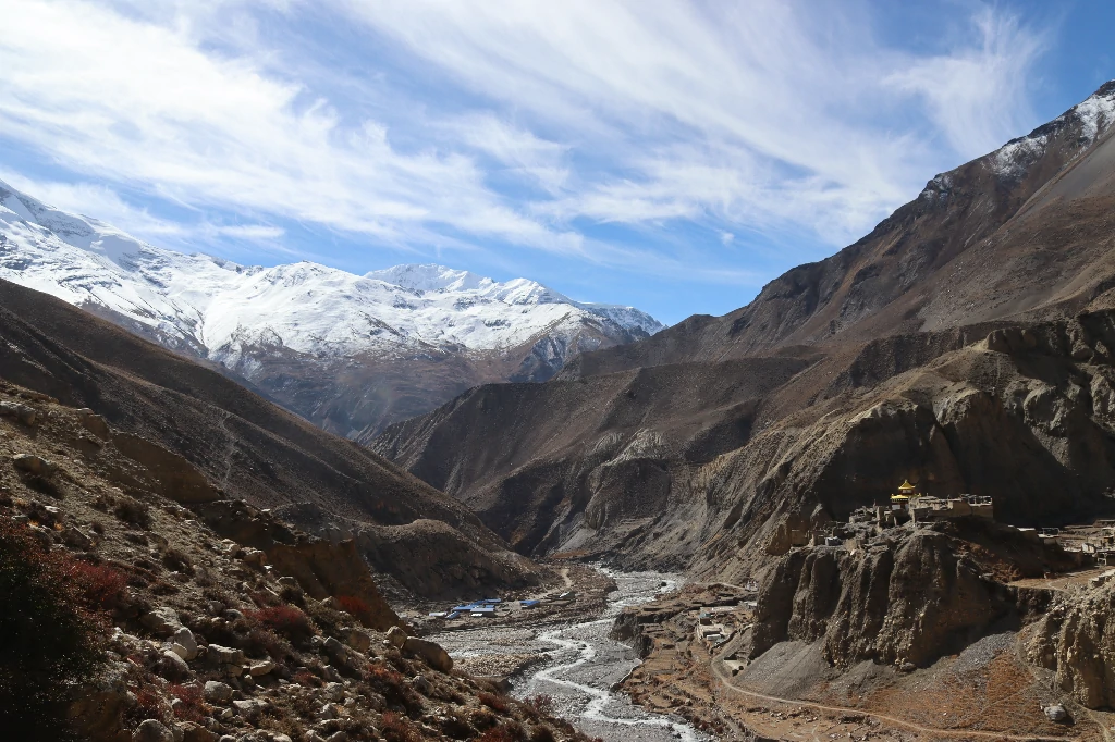
You start with a long, bumping drive from Kathmandu to Koto. That’s where you step off the main trekking highway and cross into a restricted zone. The landscape shifts almost instantly. You’ll cross wooden cantilever bridges hanging over the roaring Phu Khola river. You’ll climb through tight, pine-filled gorges until you hit the secluded villages of Phu Gaon and Nar. The stone houses and ancient monasteries up here don’t look like they were built by hand. They look like they sprouted straight out of the rock. Modern tourism hasn’t really touched this place yet.
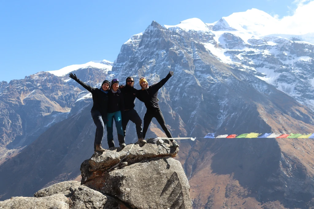
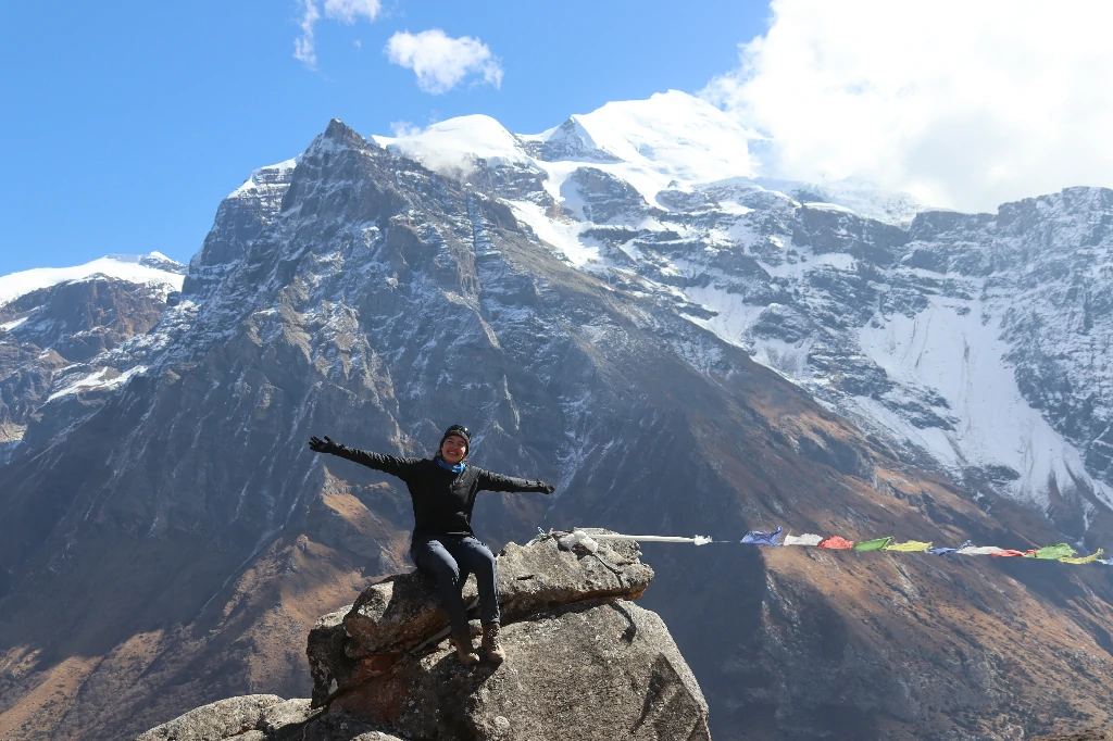
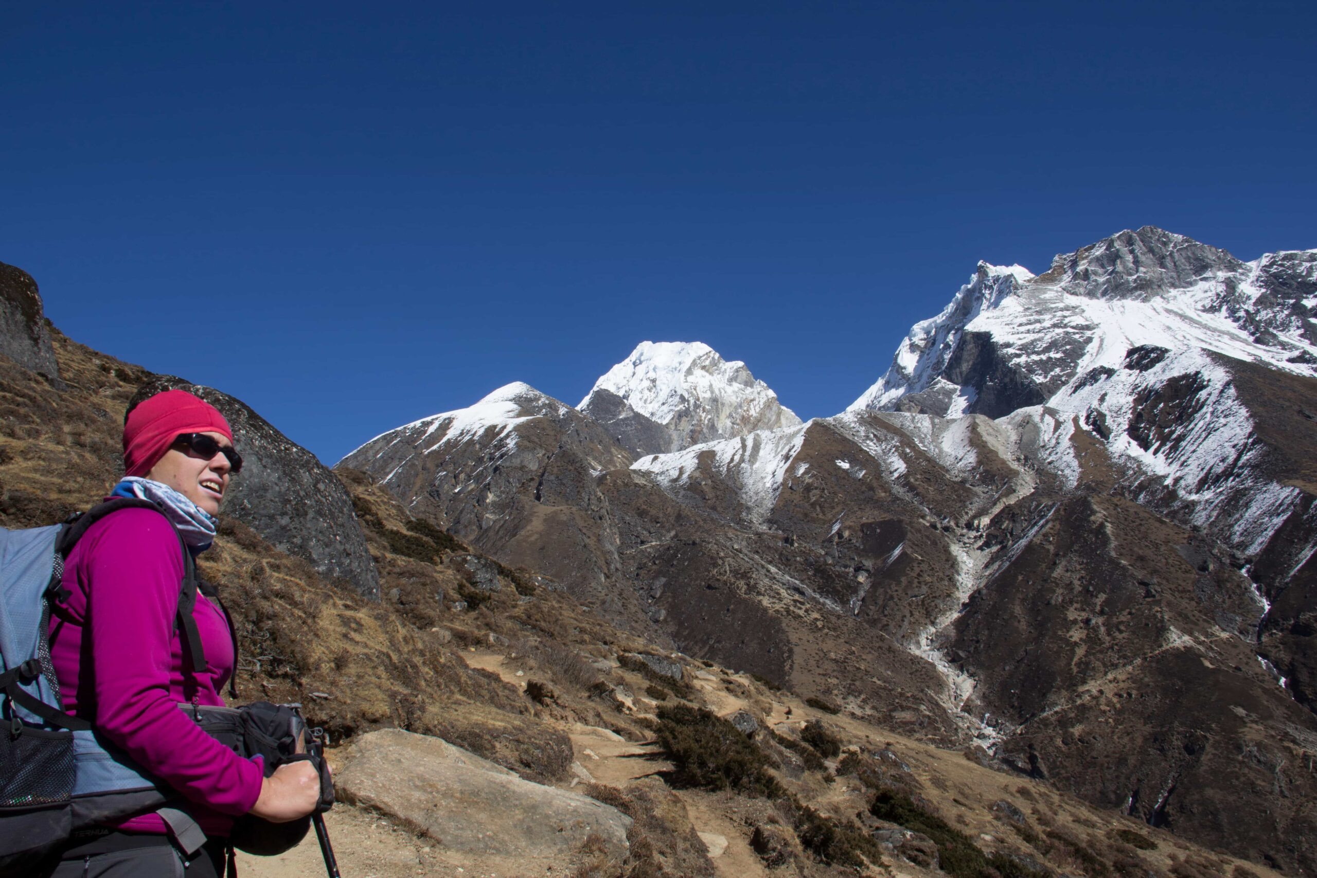
Then comes the physical gear shift. After days of quiet acclimatization, you hit Kang La (5,240m). It’s a steep, lung-burning climb. But crossing it pulls you entirely out of the hidden valley and drops you right onto the famous Annapurna Circuit. The contrast hits you hard. You trade total wilderness for an ancient trade route, pushing upward again toward Thorong La (5,416m)—one of the highest trekking passes in the world.
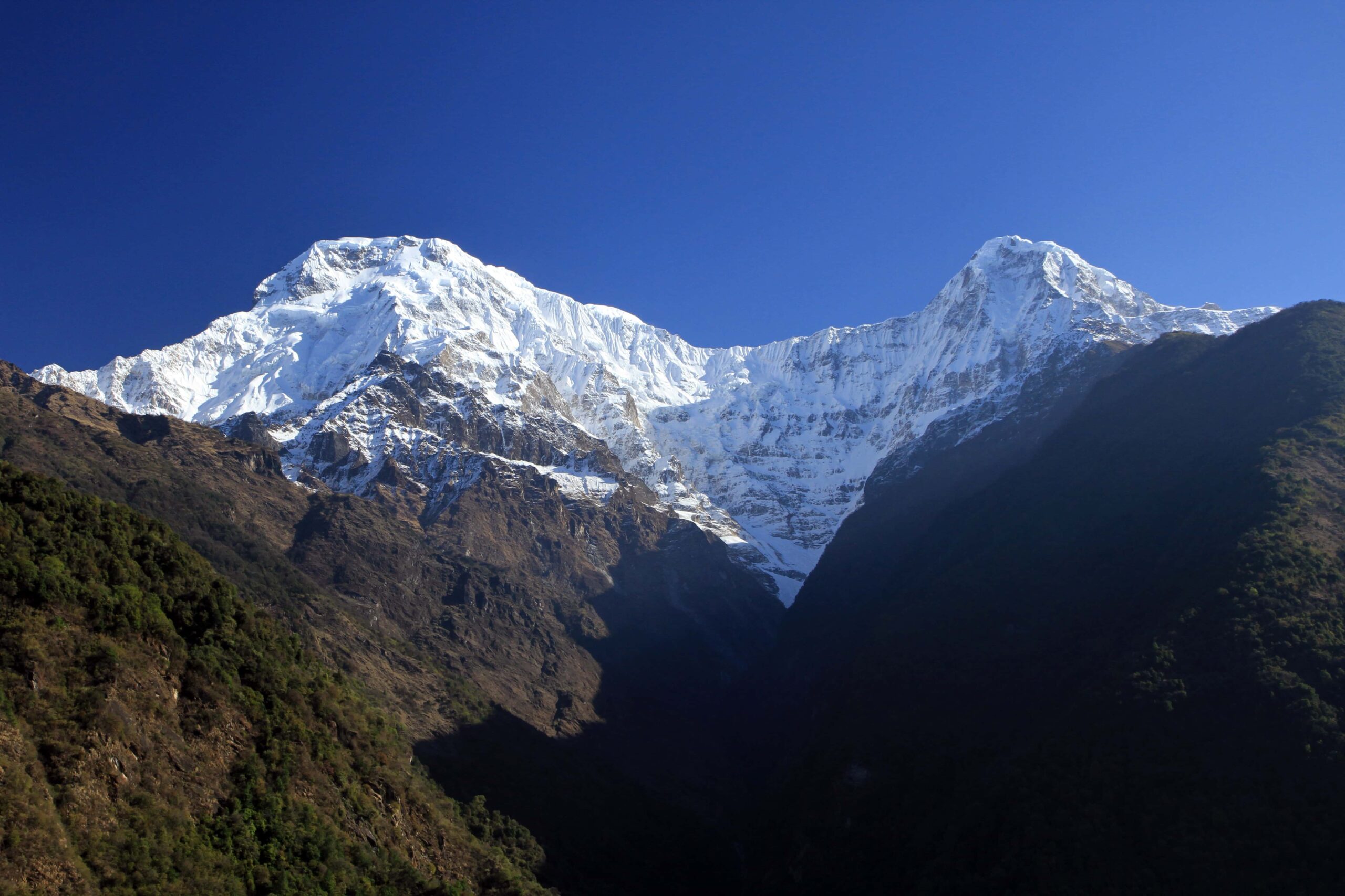
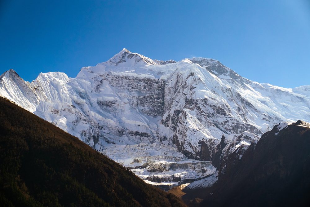
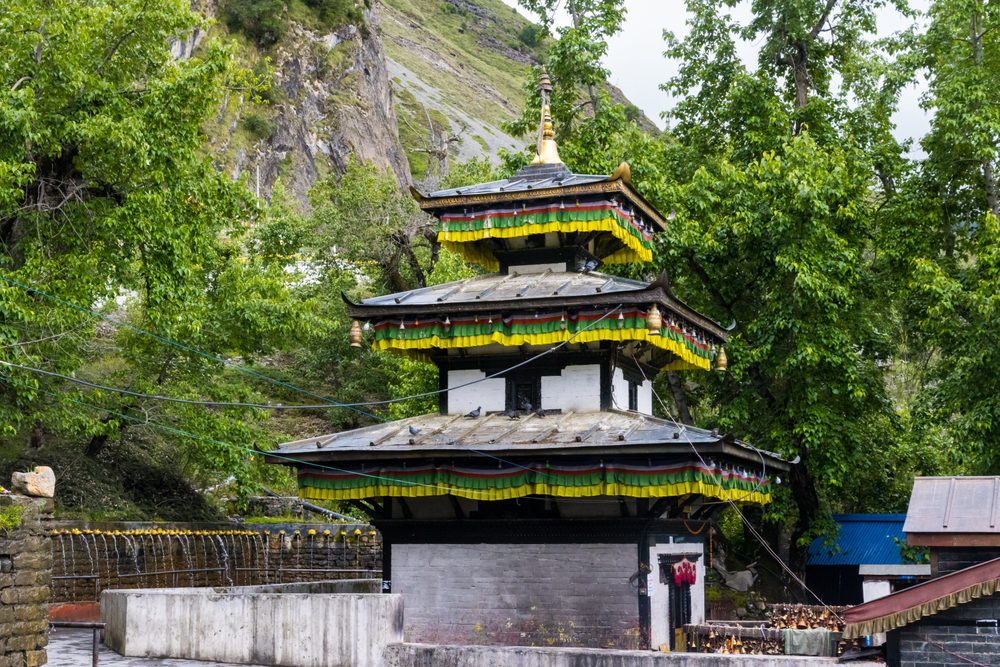
Coming down the other side feels like a massive relief. You walk straight into Muktinath Temple, sharing the trail with Hindu and Buddhist pilgrims bathing in freezing water spouts. From there, it’s a ride back down to Pokhara. In just 12 days, you get the absolute extremes of Nepal. Total silence in Nar Phu. The brutal reality of crossing two massive mountain passes. And neck-craning views of Annapurna II, Tilicho Peak, and Himlung Himal the whole way through.
🏔️ Trek Highlights
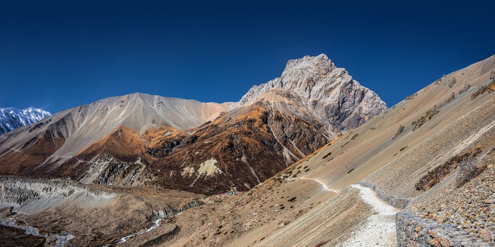
- Watch the landscape flip: Start in deep pine forests and river gorges, then climb straight up into a barren, high-altitude alpine desert.
- Ditch the crowds: Trek into the restricted Nar Phu Valley. It takes special permits to get in, meaning you can walk for days without bumping into another commercial trekking group.
- Two massive passes in one trip: Test your legs on the steep Kang La (5,240m) before taking on the legendary Thorong La (5,416m).
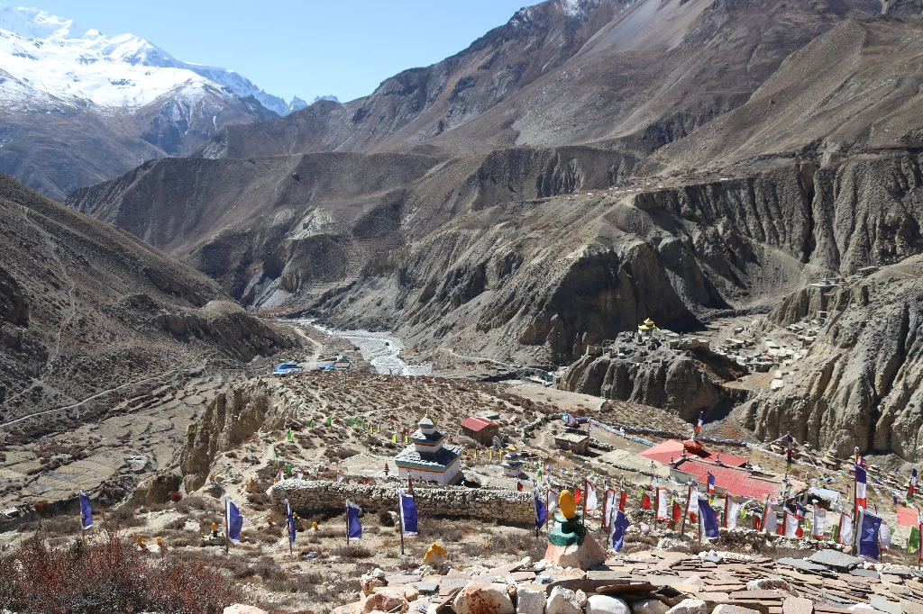
- See untouched Tibetan culture: Walk through Nar and Phu Gaon. No roads, no modern noise—just stacked-stone houses and traditions that haven’t changed in centuries.
- Walk under Himalayan giants: Get massive, unobstructed views of Annapurna II, Gangapurna, Tilicho Peak, and Himlung Himal.
- Step inside Tashi Lhakhang: Visit one of the oldest, most remote monasteries in the entire Himalayan range.
- End at a sacred pilgrimage site: Finish the hard climbing at Muktinath Temple alongside Hindu and Buddhist pilgrims.
Itinerary
Your Journey, Step by Step
Trek from Koto to Meta (3,560m) – 6-7 hours
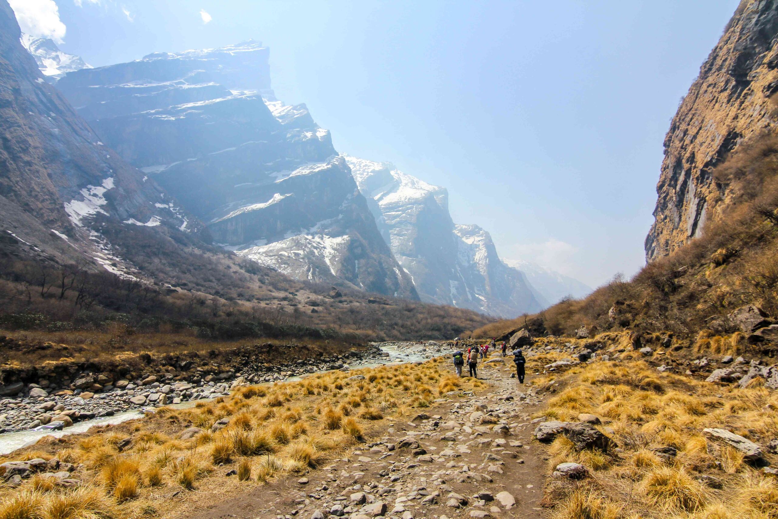
Right after breakfast, you register your restricted area permits at the police checkpoint and step off the busy Annapurna Circuit. The difference is instant. You enter the Nar Phu Valley gorge, walking through dense, quiet pine forests. The trail here is narrow, following the Phu Khola river. You cross a series of wooden cantilever bridges and climb steep sections cut into the rock. Eventually, the treeline drops away and you emerge onto the flat, wide-open plateau of Meta. It’s completely silent up here compared to the main trails.
Max. Altitude: Meta (3,560 m / 11,680 ft)
Duration: 6–7 hrs
Overnight at a teahouse
Breakfast, Lunch & Dinner included
Trek from Meta to Phu Gaon (4,250m) – 6-7 hours
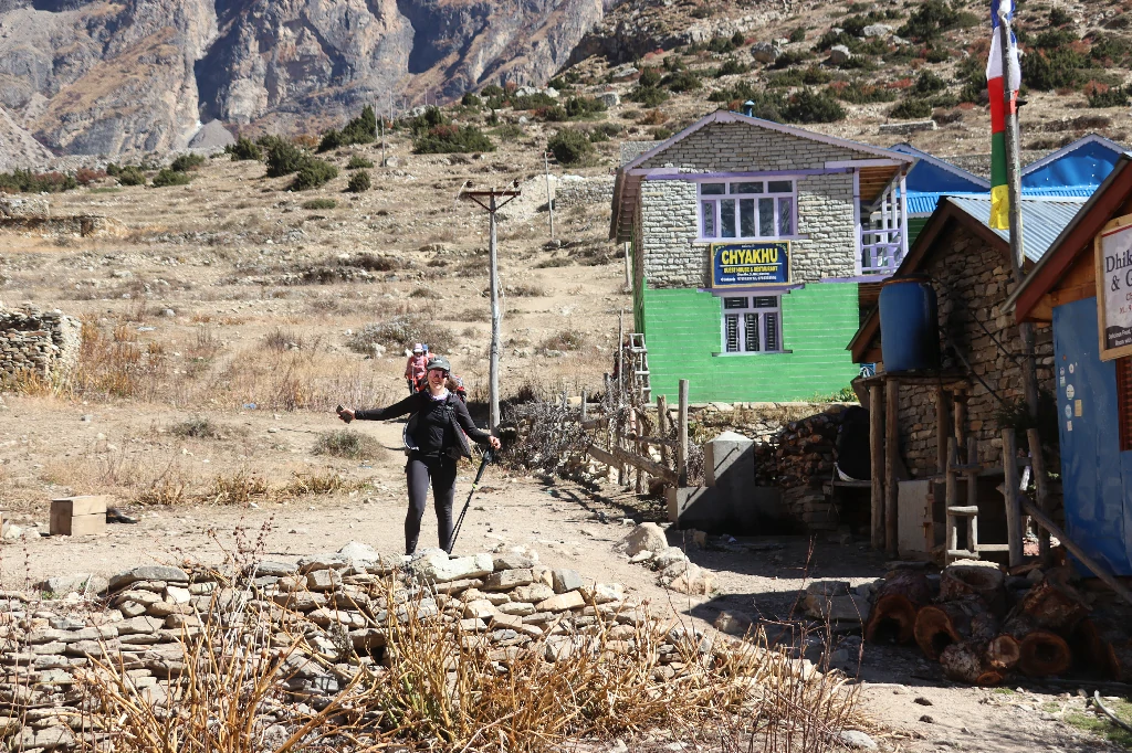
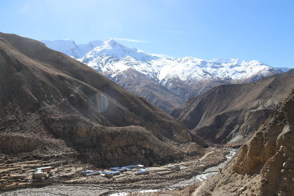
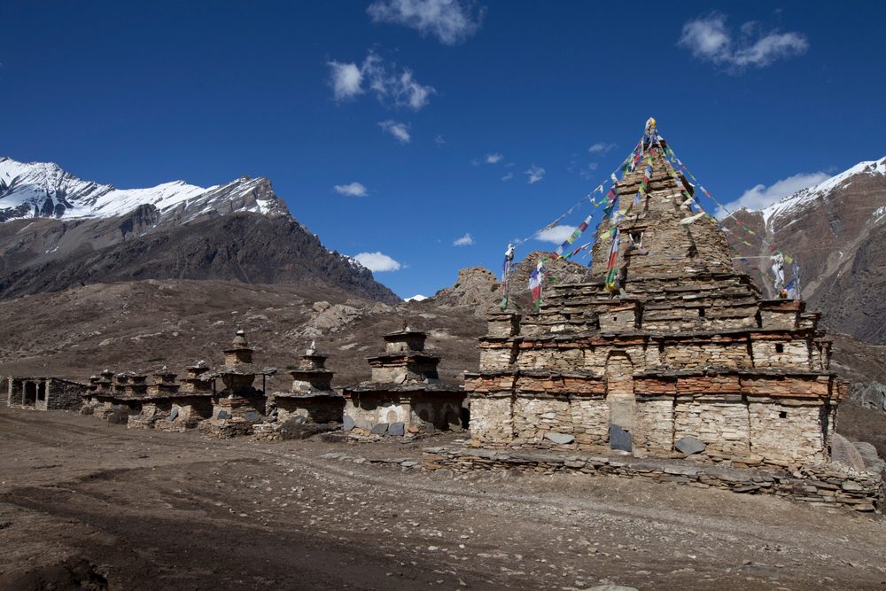
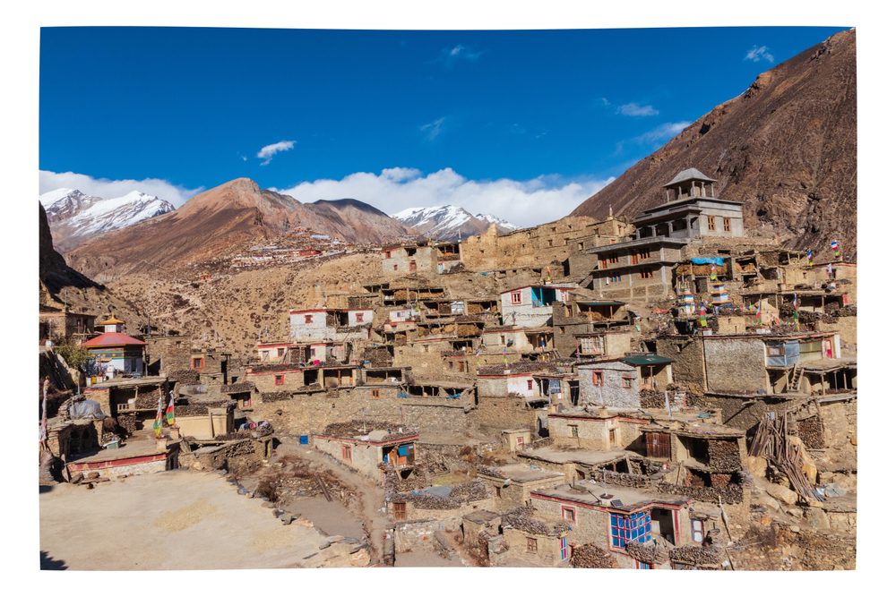
You push deeper into the valley today. The landscape gets harsher, drier, and deeply Tibetan. You’ll walk past the winter settlements of Chyakhu and Kyang—mostly empty, ruined stone forts that Khampa warriors used decades ago. The trail dips and climbs until you finally spot it: Phu Gaon. It’s a tiny, stacked-stone village clinging to the side of a mountain. It looks like it hasn’t changed in five hundred years. Yaks wander the narrow alleys, and the local monastery rituals echo across the valley.
Max. Altitude: Phu Gaon (4,250 m / 13,943 ft)
Duration: 6–7 hrs
Overnight at a teahouse
Breakfast, Lunch & Dinner included
Acclimatization Day in Phu Gaon
No packing your duffel bag today. At 4,250 meters, your body needs a minute to figure out the thin air. You’ll take a slow hike up to Tashi Lhakhang Monastery, one of the oldest and most isolated Buddhist sites in the Himalayas. It’s a great place to just sit, drink butter tea, and watch the monks. Later, you can hike up to a nearby ridge. The views of Himlung Himal and Kang Guru from up there are massive. Spend the afternoon resting.
Max. Altitude: Phu Gaon (4,250 m / 13,943 ft)
Duration: 2–3 hrs (optional hiking)
Overnight at a teahouse
Breakfast, Lunch & Dinner included
Trek from Phu Gaon to Nar Phedi (3,490m) – 5-6 hours
You retrace your steps back down the valley for a few hours, then branch off at the river gorge heading toward Nar. You’ll cross an impressive suspension bridge spanning a deep, 80-meter drop over the Mahendra Pul. Tonight is unique. There isn’t a standard teahouse in Nar Phedi—you actually sleep at the local monastery. The rooms are basic, but you eat in the communal dining hall and get to listen to the monks perform their evening chants. It’s one of the most authentic nights on the trail.
Max. Altitude: Nar Phedi (3,490 m / 11,450 ft)
Duration: 5–6 hrs
Overnight at the Monastery Guesthouse
Breakfast, Lunch & Dinner included
Trek from Nar Phedi to Nar Village (4,110m) – 3-4 hours
A short day on paper, but it’s entirely uphill. You climb a series of steep, relentless zig-zags. Just when your legs are burning, the valley completely opens up into Nar Village. It’s larger and more spread out than Phu, surrounded by terraced barley fields. Women weave wool on hand looms outside their homes, and the local culture is heavily rooted in Tibetan Buddhism. Spend the afternoon hydrating and eating as much as you can. Tomorrow is the hardest day of the trek.
Max. Altitude: Nar Village (4,110 m / 13,484 ft)
Duration: 3–4 hrs
Overnight at a teahouse
Breakfast, Lunch & Dinner included
Trek from Nar Village to Kang La Pass (5,240m) to Ngawal (3,660m) – 7-9 hours
Wake up in the dark. Headlamp on. The climb to Kang La Pass is a steep, loose, lung-busting grind. You take it one slow step at a time. But breaking over the top of the pass makes every bit of the pain worth it. Suddenly, the entire Annapurna range is right in your face: Annapurna II, Gangapurna, and Tilicho Peak lined up in a massive wall of ice. After taking it in, you face a brutal, steep descent. It’s tough on the knees. You drop all the way down into Ngawal, officially rejoining the Annapurna Circuit.
Max. Altitude: Kang La Pass (5,240 m / 17,191 ft)
Duration: 7–9 hrs
Overnight at a teahouse
Breakfast, Lunch & Dinner included
Trek from Ngawal to Manang (3,540m) – 3-4 hours
After the absolute isolation of Nar Phu, walking into Manang feels like hitting a metropolis. The trail today is mostly flat, wide, and heavily trekked. You’ll pass the historic Braga Monastery tucked into the cliffs along the way. Manang town has bakeries, real coffee, gear shops, and hot showers. Spend the afternoon eating pastries, walking up to the viewpoint over Gangapurna Lake, and resting your legs.
Max. Altitude: Manang (3,540 m / 11,614 ft)
Duration: 3–4 hrs
Overnight at a teahouse
Breakfast, Lunch & Dinner included
Trek from Manang to Yak Kharka (4,110m) – 4-5 hours
You leave the tree line completely behind today. The trail climbs steadily, leaving the Marsyangdi valley and heading into harsh, dry alpine scrubland. You’ll walk past high grazing pastures, dodging herds of yaks and the occasional blue sheep on the cliffs. It’s a deliberately short walking day. At this altitude, going slow is the only way to keep altitude sickness away. You’ll arrive at Yak Kharka by lunchtime.
Max. Altitude: Yak Kharka (4,110 m / 13,484 ft)
Duration: 4–5 hrs
Overnight at a teahouse
Breakfast, Lunch & Dinner included
Trek from Yak Kharka to Thorong Phedi (4,600m) – 4-5 hours
A slow, steady push toward the base of the pass. The air is noticeably thin, and every uphill step feels heavy. You’ll cross a narrow landslide area—keep your head up and move quickly through it—before arriving at Thorong Phedi. It’s a cluster of basic lodges packed tightly into a rocky bowl at the bottom of the mountain. Eat a massive bowl of garlic soup, pack your daybag for tomorrow, and try to get to sleep before the sun goes down. Wake-up is usually around 3:00 AM.
Max. Altitude: Thorong Phedi (4,600 m / 15,091 ft)
Duration: 4–5 hrs
Overnight at a teahouse
Breakfast, Lunch & Dinner included
Trek from Thorong Phedi to Thorong La Pass (5,416m) to Muktinath (3,800m) – 7-9 hours
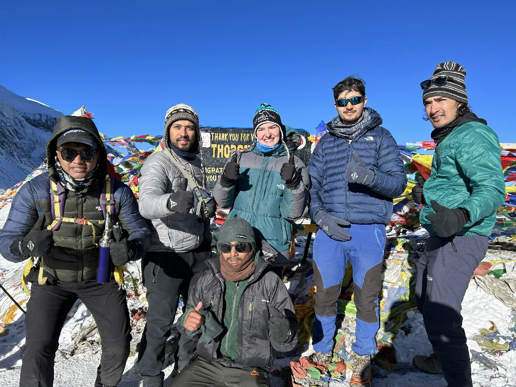
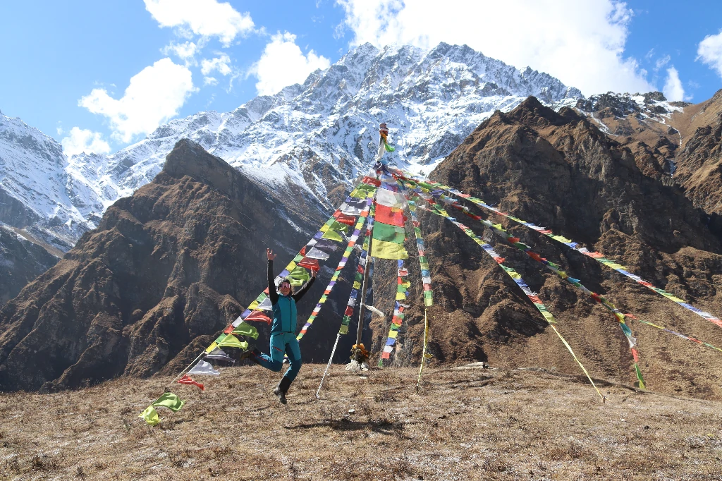
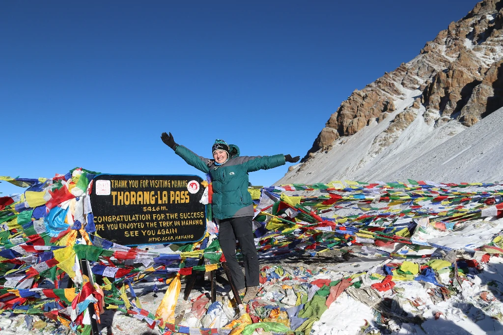
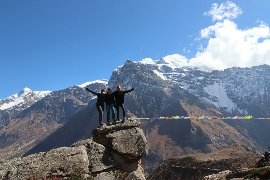
The big one. You start walking under the stars in freezing temperatures. It is a slow, relentless slog up the moraine. False summits will test your patience. Just when you think you can’t climb anymore, you’ll see the massive pile of prayer flags marking Thorong La Pass. Take your photos, catch your breath, and celebrate. But don’t stay too long—the wind up here is vicious. You then start the massive 1,600-meter drop down to Muktinath. Your knees will hate you, but walking into the temple town feels like an absolute victory.
Max. Altitude: Thorong La Pass (5,416 m / 17,769 ft)
Duration: 7–9 hrs
Overnight at a teahouse
Breakfast, Lunch & Dinner included
Drive from Muktinath to Jomsom to Pokhara
No more walking. You grab a local jeep and bounce your way down the dusty, wind-scoured Kali Gandaki gorge to Jomsom. From there, you have two choices. You can take the 20-minute morning flight to Pokhara—which slips right between the peaks of Annapurna and Dhaulagiri and is worth every penny—or you can take the long, bumpy bus ride down the mountain. Either way, you end the day in Pokhara. Hot shower, thick air, and a cold beer by the lake.
Max. Altitude: Muktinath (3,800 m / 12,467 ft)
Duration: 1–2 hrs jeep, plus 20 min flight (or 8 hr drive)
Overnight at a hotel in Pokhara
Breakfast included
Customize this trip with help from our local travel specialist that matches your Interests.
Customize This TripInclusions
What’s Covered in Your Adventure
- Private car service to and from the airport.
- One nights at a standard hotel in Kathmandu with breakfast.
- Three meals a day: breakfast, lunch, & dinner.
- Kathmandu to Beshishar by bus Beshishar to meta by jeep.
- You will be provided with Trekking Lodges (Tea Houses) during the trek.
- Nar phu valley restricted area permit (special permit).
- A highly experienced, helpful, knowledgeable, friendly, English-speaking guide with all of his salary, food, drinks, lodging, transportation, and insurance covered.
- Setting up a service for an emergency helicopter (paid by your Travel Insurance company).
- You can rent a sleeping bag, a down jacket, and a free duffel bag return to be after the trip.
- Taxes and official costs paid to the government.
- Certificate of completion of the trip.
- Oximeter to check your pulse, oxygen saturation, and heart rate twice a day (very helpful to check for signs of Altitude Mountain Sickness, or AMS). This will make sure that your trek is in the safest hands possible, no matter how experienced you are.
- Muktinath to Jomsom to Pokhara by jeep.
- Food that you will eat in Kathmandu for lunch and dinner.
- The cost of a visa to enter Nepal.
- Your insurance for travel and medical care.
- International airfare Your Personal expenses.
- All of the alcoholic and non-alcoholic cold and hot drinks you buy on trek (along the way and in the Tea Houses at night).
- All of the sweet desserts, like chocolate, cake, pie and pudding.
- The tea houses have hot showers and places to charge your phone which will cost you about 2$ to 5$.
- Tip to the guide, (Tipping is expected).
- Strong, helpful Sherpa porters with the right safety gear and walking gear, as well as a salary, food, a place to live, and insurance. (one porter for two people) it will cost you $280 USD.
Maps
Navigate Your Journey
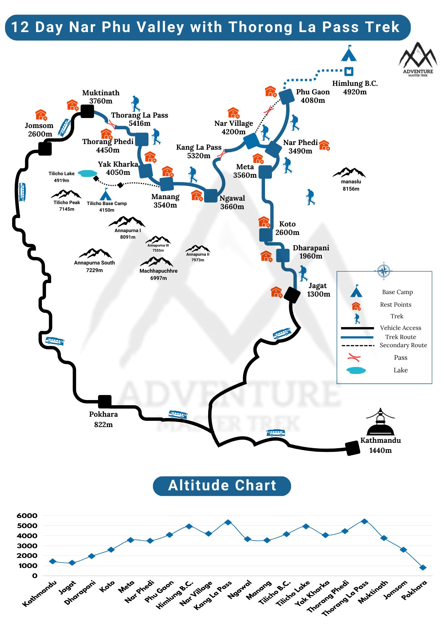
Good to Know
Your Journey, Step by Step
Accommodation on the Nar Phu Valley Trek
The accommodation situation on the Nar Phu Valley trek is honest and worth understanding before you go, because it varies considerably between the lower approach section and the remote upper valley.
Lower Approach — Besisahar to Koto
The stretch from Besisahar through to Dharapani and Koto runs through the main Annapurna Circuit corridor, and the teahouses here are the better-developed variety that the Annapurna region is known for. Private rooms are available at most stops, hot showers are standard at Dharapani and common further down the trail, and the dining rooms are decent. This section is where you sleep the most comfortably on the entire route.
Koto and Meta
Koto is the last checkpoint before you enter the restricted valley and the teahouses here are solid. Private rooms, shared bathrooms, basic but clean. Electricity for charging is available. Meta, the first overnight stop inside the restricted zone, is simpler — shared rooms are more common, facilities more basic, but warm bedding is provided and the dining area is reliably functional. Expect to pay NPR 500–800 for a room here, with the price covering bed and blanket.
Phu Village
Phu sits at 4,080 metres and is one of the most remote inhabited settlements in Nepal. The accommodation here is teahouse-style in stone buildings that look exactly like what they are — ancient Tibetan-style architecture adapted over time to accept paying guests. Rooms are small, heating is minimal, and the shared bathrooms are basic. Some teahouses have started upgrading in recent years with better mattresses and insulation, but you should go in expecting simple rather than comfortable.
Bring a sleeping bag rated to -15°C for the nights in Phu. The blankets provided at the teahouses are not sufficient in winter or late autumn, and even in October the nights at this elevation are genuinely cold.
Nar Village
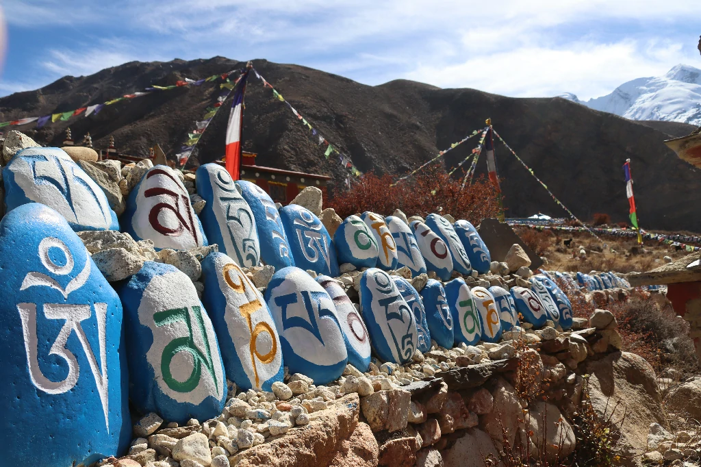
Nar is slightly lower than Phu and has a more established infrastructure as a result of being on the exit route from the valley. The teahouses here are among the better ones in the restricted zone — some have solar-powered heating in the dining areas, and the food menu is slightly wider than what you find at Phu. The village itself is a beautiful cluster of whitewashed stone buildings with prayer wheels and mani walls, and staying here for a rest day rather than just a transit night is worth building into the itinerary if the schedule allows.
Camping Option
The Nar Phu Valley trek can also be done as a camping trek, which gives you more flexibility in staging and removes the dependency on teahouse availability in the peak season. Camping is the right choice if you are moving through with a larger group or if you are trekking in the winter months when some teahouses close. The cost is higher than a teahouse trek because you need to carry all camping equipment.
Key Points on Booking
There are a limited number of teahouses in the restricted valley, particularly in Phu. In October and in April, these fill up. Book through your trekking agency before you leave Kathmandu rather than assuming availability will sort itself out on the trail. The difference between a warm room and sleeping in the dining area comes down to whether your agency called ahead.
Permits for the Nar Phu Valley Trek
The Nar Phu Valley is a restricted area of Nepal. You cannot enter without the correct permits, you cannot get those permits without a licensed trekking agency, and you cannot trek here independently. Those three rules are fixed, and there are checkpoints along the route where they are enforced. Getting this sorted before you leave Kathmandu is not optional paperwork — it is the condition for the trek happening at all.
- Restricted Area Permit (RAP)
This is the main permit specific to Nar Phu Valley and the one that makes this route different from most other Nepal treks. The government introduced it to control tourist numbers, protect the fragile ecosystem, and preserve the Tibetan Buddhist cultural heritage of the valley’s communities.
The RAP can only be obtained through a registered trekking agency. Solo travellers cannot apply for it independently. The minimum group size is two people — you cannot get the permit as a solo trekker.
Cost:
- September to November (peak season): USD 100 per person for the first 7 days, plus USD 15 per person per additional day
- December to August (off-season): USD 75 per person for the first 7 days, plus USD 15 per person per additional day
The permit is issued by the Department of Immigration in Kathmandu. Your agency handles the application process with your passport copy and passport-sized photos.
- Annapurna Conservation Area Permit (ACAP)
The Nar Phu Valley lies within the Annapurna Conservation Area, so the ACAP permit is required in addition to the RAP. This permit covers the entire conservation area and funds environmental protection, trail maintenance, and community programs throughout the region.
Cost: USD 25–30 per person (single entry, valid for the duration of the trek)
The ACAP is available at the Nepal Tourism Board offices in both Kathmandu and Pokhara, or through your agency.
- TIMS Card (Trekkers’ Information Management System)
The TIMS requirement has changed in recent years. For the core Nar Phu Valley route, TIMS is not currently mandatory. However, if you are extending the trek to include the Annapurna Circuit — which many trekkers do, exiting via Ngawal or Manang — then TIMS is required for that connecting section.
Cost: USD 10 through a registered agency; USD 20 for independent trekkers
Check the current requirement with your agency at the time of booking, as this provision has changed before and may change again.
Full Permit Cost Summary
| Permit | Peak Season (Sep–Nov) | Off-Season (Dec–Aug) | Where to Get |
| Restricted Area Permit (RAP) — first 7 days | USD 100 | USD 75 | Department of Immigration, Kathmandu (via agency) |
| RAP — each additional day | USD 15 | USD 15 | Same |
| ACAP | USD 25–30 | USD 25–30 | Nepal Tourism Board, Kathmandu or Pokhara |
| TIMS (if extending to Annapurna Circuit) | USD 10 (via agency) | USD 10 | Nepal Tourism Board or TAAN office |
Documents Required:
- Passport with at least 6 months of validity remaining
- Two passport-sized photographs
- Nepal entry visa
- Confirmed booking with a registered trekking agency
Food on the Nar Phu Valley Trek
The food on the Nar Phu Valley trek follows the same basic logic as most remote Nepal routes — dal bhat carries the weight, everything else fills the gaps — but the upper valley adds a Tibetan dimension to the menu that makes it genuinely different from trekking food in the Everest or Annapurna Base Camp corridors.
The Staples
Dal bhat is the foundation at every teahouse on the route, from Besisahar to Nar. Rice, lentil soup, vegetable curry, and pickle, served hot and refillable at most teahouses. It is what the local guides and porters eat every day, and the logic of it — high carbohydrate, easy to digest at altitude, warming — becomes very clear after a few days on the trail. At higher elevations, where supplies are flown in by helicopter or carried by porters, the portions may be slightly smaller, but the dish itself remains consistent.
Tibetan Additions
Once you are through Koto and into the restricted valley, the menu develops a distinctly Tibetan character. Tsampa — roasted barley flour mixed with tea, butter, or water into a thick paste — is both a staple food and a ceremonial offering in the Buddhist culture of Nar and Phu. Trekkers who eat it often for the first time find it dense and acquired, but at altitude it is effective fuel. Tibetan bread — a thick, flat, fried dough served with honey or jam — is a reliable breakfast staple and considerably more interesting than the packaged crackers that come out as altitude increases.
Thukpa, the Tibetan noodle soup, is warm, filling, and well suited to cold evenings at 4,000 metres. Most teahouses at Nar and Phu have it on the menu year-round. Butter tea — salt, butter, and black tea churned together — is the traditional warming drink of the high valley and is offered in most homestays as a welcome gesture. It is an acquired taste. Accept it when it is offered.
Vegetables and Freshness
The potatoes grown in the Nar Phu region are notably good — dense, naturally grown at altitude, and genuinely flavourful in a way that lowland potatoes are not. They appear boiled, fried, or curried throughout the menu and are worth ordering. Seasonal vegetables are available at lower elevations and in the main villages, but the variety narrows at altitude. Do not expect fresh salad above Koto.
Meat
The Buddhist culture of the upper valley means that meat is not widely available or cooked in the villages of Nar and Phu. Most teahouses in these villages are vegetarian by practice. Below Koto, chicken and eggs appear on menus. Trekkers who eat meat should plan for a largely vegetarian stretch in the upper valley — this is worth knowing in advance rather than discovering on arrival.
Garlic Soup
Every trekker you meet on this route will mention garlic soup. It appears on menus across the Annapurna region and carries a specific reputation as an altitude remedy. There is no clinical proof that it prevents AMS, but it is warm, flavourful, and widely available. At 4,000 metres with a long day behind you and the temperature dropping, the evidence for it feels fairly convincing.
Prices
Food prices increase with altitude and distance from the road. At Besisahar, a full dal bhat meal costs around NPR 350–500. At Phu village, the same meal costs NPR 600–800 or more. Budget USD 25–35 per day to cover three teahouse meals on the trail, with some room for drinks and snacks.
Electricity and Communication on the Nar Phu Valley Trek
The honest version of this section is: expect very little, carry everything you need, and treat connectivity as the exception rather than the default.
Electricity
Power on the Nar Phu trek comes from solar panels and, in some lower settlements, from small micro-hydro installations. The solar capacity at most teahouses is enough for lighting and sometimes for charging one or two devices at a time. In villages like Koto and Meta, charging is reliable. In Phu and Nar, it is available but the solar input varies with weather — a cloudy day reduces the output considerably, and if there are several trekkers competing for the same socket, expect to wait.
Charging at teahouses costs NPR 100–300 per device depending on location. Higher up, the price is higher and the availability is lower. Carrying a high-capacity power bank — 20,000 mAh at minimum — is the practical solution. Charge it fully in Besisahar or Dharapani before the trail narrows and the solar dependency begins. A small fold-out solar panel is worth considering for the high village nights when teahouse power is limited.
Mobile Network
Two network providers operate in Nepal — NTC (Nepal Telecom) and Ncell. Of the two, NTC has the significantly better coverage on this route. The Ncell signal effectively disappears above Meta and is unreliable even in the lower gorge sections. NTC continues into the upper valley and reaches the main villages of Phu and Nar with intermittent but usable signal in good weather.
Buy an NTC SIM card in Kathmandu at the airport or in Thamel. The registration requires a passport copy and a photograph. Load a data package before you leave the city — the packages available in Kathmandu are better value than anything you can buy at the trail checkpoints.
No signal is reliable in the gorge sections between Koto and Meta. The narrow canyon walls block most reception. Above the gorge, at Meta and beyond, NTC coverage becomes patchy but present. At Nar village specifically, the signal is strong enough for calls and light data use.
Wi-Fi
Wi-Fi exists at teahouses in the lower sections — Besisahar, Dharapani, and Koto all have it, though speeds vary. Above Koto, Wi-Fi is available at some teahouses in Meta, Nar, and occasionally Phu, but the bandwidth is limited to messaging and small uploads. Video calls are not realistic. Download everything you need — maps, entertainment, documents — before entering the restricted zone.
Expect to pay NPR 200–500 for Wi-Fi access at individual teahouses in the higher villages. The password systems are informal and the quality varies considerably by day and by how many other trekkers are using it simultaneously.
Emergency Communication
Your trekking agency should carry a satellite communication device for all remote sections of this route. In the event of a genuine emergency — medical evacuation, serious weather hold, injury — this is the only reliable communication tool between Koto and the outside world. Do not assume your mobile phone will work in a crisis. Make sure your guide has satellite capability before the trek begins.
Connectivity and Charging — Location Table
| Location | Altitude | Electricity | Charging Cost | NTC Mobile | Ncell Mobile | Wi-Fi |
| Kathmandu | 1,400m | Full grid | Standard | Excellent | Excellent | Excellent |
| Besisahar | 760m | Full grid | Standard | Strong | Strong | Good |
| Dharapani | 1,960m | Grid + solar | NPR 100–200 | Strong | Moderate | Available |
| Koto | 2,600m | Solar + micro-hydro | NPR 150–250 | Good | Weak | Available (slow) |
| Meta (Nar Phedi) | 3,560m | Solar | NPR 200–300 | Intermittent | None | Very limited |
| Phu Village | 4,080m | Solar | NPR 200–300 | Intermittent | None | Rare / slow |
| Nar Village | 4,110m | Solar + micro-grid | NPR 150–200 | Moderate | None | Available at some teahouses |
| Kang La Pass | 5,322m | None | Not available | None | None | None |
| Ngawal (exit) | 3,657m | Solar | NPR 150–200 | Moderate | Weak | Available |
Transportation to the Nar Phu Valley Trek
Getting to the trek starting point is itself a journey worth planning carefully. The Nar Phu Valley trek begins at Koto, which is reached via Besisahar. Besisahar is accessible from Kathmandu by road. There are no direct flights to the trailhead — the only way in is by surface transport from Kathmandu or via a combination of a flight to Pokhara followed by a road transfer.
By Bus
The bus is the cheapest and most used way to reach Besisahar from Kathmandu. The route runs along the Prithvi Highway — the main east-west artery connecting Kathmandu to Pokhara — before branching north at Dumre toward Besisahar.
Kathmandu to Besisahar — Local Bus
Local buses depart from Gongabu Bus Park in Kathmandu, which sits about 3 kilometres north of Thamel. The drive covers approximately 176 kilometres and takes 6 to 8 hours depending on traffic and road conditions. The road from Dumre to Besisahar is rougher than the highway stretch and adds time in wet conditions or after monsoon landslides.
The local bus is crowded, unair-conditioned, and stops frequently for passengers and lunch breaks. It is not comfortable, but it works and it gives you an unfiltered view of the Nepalese countryside along the Trishuli River valley. For trekkers on a tight budget, or for those who want the full ground-level Nepal experience from the very start, the local bus is a legitimate choice.
- Departure point: Gongabu Bus Park, Kathmandu
- Cost: NPR 600–800 per person (approximately USD 4–6)
- Duration: 6–8 hours
- Departure times: Early morning, typically 6:00–7:30 AM
- Booking: Buy the ticket at the bus park counter on the day of travel
Kathmandu to Besisahar — Tourist Bus
Tourist buses run the same route but in more comfortable, dedicated vehicles — air conditioning is standard, seats are assigned, and the stops are more predictable. Several companies operate this service with departures from Thamel hotels and the tourist bus park near Thamel.
- Cost: NPR 800–1,200 per person (approximately USD 6–9)
- Duration: 6–7 hours
- Booking: Through your hotel, trekking agency, or at the tourist bus park in Thamel
Besisahar to Koto
From Besisahar, the trail continues north to Koto — but most trekkers take a shared jeep or a local microvan from Besisahar up to Chame or Dharapani to avoid the lower road sections, which are well-trodden Annapurna Circuit trail rather than meaningful wilderness trekking.
The road from Besisahar to Chame is rough but passable in a 4WD jeep. Shared jeeps operate daily and fit 6–8 passengers in the back. From Chame or Dharapani, the trail to Koto is one day of walking.
- Shared jeep, Besisahar to Chame: NPR 700–1,000 per person
- Duration: 3–4 hours
- Private jeep hire, Besisahar to Chame: NPR 8,000–12,000 per vehicle
By Plane
There are no direct flights to Besisahar or to any point on the Nar Phu approach route. The flight option means flying Kathmandu to Pokhara first, then taking road transport from Pokhara north to Besisahar. This combination is faster than the full bus journey and more comfortable, though it costs considerably more.
Kathmandu to Pokhara by Plane
Multiple domestic airlines operate this route daily. The flight takes 25–30 minutes and lands at Pokhara Regional International Airport. Flights operate throughout the day, with the best visibility and most reliable departures in the morning.
- Airlines: Buddha Air, Yeti Airlines, Shree Airlines, Nepal Airlines
- Cost: USD 80–120 per person (prices fluctuate significantly by season and booking timing)
- Duration: 25–30 minutes
- Booking: Through your trekking agency, airline websites, or local travel agents in Thamel
- Note: Book in advance during October and April — these flights fill quickly in peak trekking season
Pokhara to Besisahar by Jeep
From Pokhara, Besisahar is approximately 80 kilometres northeast along a road that runs through the lower Marsyangdi River valley. The drive takes 2.5 to 3.5 hours by private jeep, or longer by shared transport.
- Private jeep, Pokhara to Besisahar: NPR 6,000–9,000 per vehicle
- Shared jeep: NPR 500–700 per person
- Duration: 2.5–3.5 hours
Combined Cost Comparison
| Route | Option | Cost Per Person (approx.) | Total Time |
| Kathmandu → Besisahar | Local bus | USD 4–6 | 6–8 hours |
| Kathmandu → Besisahar | Tourist bus | USD 6–9 | 6–7 hours |
| Kathmandu → Besisahar | Private jeep | USD 25–35 (shared among group) | 5–6 hours |
| Kathmandu → Pokhara (flight) + Pokhara → Besisahar (jeep) | Flight + jeep | USD 90–140 | 3.5–5 hours total |
Altitude Sickness during Trek
Altitude sickness can hit on the Nar Phu trek. The air is thin up high. You might get headaches, feel dizzy, nauseous, or just wiped out. The trek gives you rest days and gentle climbs so your body can adjust. Drink lots of water, skip alcohol, and notice how you feel. If something feels off, tell your guide and rest. Most people do fine if they take it slow and follow these tips.
Money Exchange during Trek
Money options are limited on the Nar Phu trek and Thorong La Pass. It’s wise to swap your money for Nepali Rupees in Kathmandu or Pokhara before the trek. On the trail, most teahouses and shops only take cash. ATMs are almost nonexistent, and cards rarely work. Carry enough money for meals, teahouses, and any extras. Smaller notes are useful—getting change can be tricky out here. A little planning before the journey makes the whole trek feel smoother on the trail.
Group size for Trek
The best group size for the Nar Phu Valley and Thorong La Pass trek is usually 2 to 6 people.Smaller groups glide along the trails with ease, giving you more time to soak in the mountains and connect with local culture. Big groups tend to bunch up on those narrow mountain paths, turning the trail a bit clumsy and slowing the whole pace. With guides and porters handling the heavy lifting, the journey feels safer—and in a small or medium group, you get more flexibility and a real chance to bond with your crew. Picking the right group size makes the trek smoother, safer, and more fun for everyone.
Travel Insurance for Nar Phu Trek
For the Nar Phu Valley and Thorong La Pass trek, travel insurance is essential. Make sure it covers high-altitude trekking, medical care, and helicopter evacuation if things take an unexpected turn. The trek passes through remote areas with little medical help. Good insurance gives you peace of mind if anything happens. Make sure your policy handles altitude sickness and emergency help. Get it before the trek and carry a copy. It lets you focus on the mountains, not potential problems.
How to Prepare for the Nar Phu Valley Trek
You can’t fake your fitness on the Nar Phu Valley and Thorong La Pass trek. It just won’t work. This 12-day route forces you over two brutal mountain passes sitting above 5,200 meters. To actually enjoy the walk, you need to spend at least three to four months building serious lung capacity and bulletproof leg strength before you even fly to Nepal. Focus heavily on weighted hikes, stair climbing, and long cardio sessions.
Do not underestimate this route. You aren’t just walking the Annapurna Circuit—you are tackling two massive, physically punishing passes back-to-back. Kang La (5,240m) is steep and loose. Thorong La (5,416m) is a freezing, hours-long grind. If your legs aren’t ready, this itinerary will break you.
1. Physical Training (Start 12 weeks out) You need lungs, and you need quads. Start running, cycling, or swimming to build your cardiovascular base. But cardio alone won’t save you on a 1,600-meter descent. You need specific leg strength. Find a steep local hill, or get on a stair machine at the gym. Put 10kg (22 lbs) in a backpack and walk up and down. Over and over. You need your knees and joints used to hours of relentless pounding.
2. Mental Resilience and Expectations Physical fitness is only half the battle here. The Nar Phu Valley is incredibly remote. You are stepping off the main tourist trail and away from modern comforts. You aren’t getting reliable Wi-Fi, fancy bakeries, or hot showers out here. You will be sleeping in basic stone teahouses, and on one night, a local monastery. It gets deeply cold at night. You have to be mentally prepared to be uncomfortable, to wake up at 3:00 AM in the freezing dark for pass crossings, and to push through when the air is painfully thin.
3. Preparing for the Altitude You cannot train for altitude at sea level. The fittest marathon runner can still get Acute Mountain Sickness (AMS). The best preparation is knowing the rules of the mountain before you arrive:
- Walk ridiculously slow. The locals call it the “Himalayan shuffle.” If you are out of breath, you are walking too fast.
- Hydrate heavily. You need to drink 4 to 5 liters of water every single day. Dehydration masks altitude sickness.
- Respect the rest days. Your acclimatization days in Phu Gaon and Manang are not optional. Use them to do a short, slow hike high up, then come back down to sleep.
4. Break in Your Boots Do not show up to Kathmandu with brand-new trekking boots. Blisters will ruin a 12-day trek faster than altitude will. Buy high-quality, waterproof boots months in advance and wear them on every training hike until they mold to your feet.
Packing List required for Nar Phu Valley with Throng La Pass trek
Preparation for the journey safely and comfortably rests on the fineness of previously written qualities delivered by us. This packing list fulfills completely the need for coats, pack gear and supplies necessary for keeping warm, needing protection and prepared for the difficulties of the trail. If you are going up to Narphu for summer or in winter, care in packing means much to you and your adventure will not be forgotten in Narphu Valley.
General:
- Passport and permits (with copies)
- Trekking insurance papers
- Nepalese Rupee Currency
- Daypack (20-30 L)
- Water bottles or Hydration system (2-3 Liter)
- UV protective sunglasses
- Sunscreen and lip balm (High SPF)
- Trekking pole
- Headlamp with extra batteries
- Camera or smart phone
Upper body:
- Lightweight moisture absorbent T-shirts (2-3)
- Long sleeve shirts (1-2) for sun and insect protection
- Warm fleece Jacket or Insulated jacket
- Waterproof / windproof jacket (shell)
- Warm hat or beanie
Lower Body:
- Comfortable trekking pants (2-pairs)
- Thermal tights or long underwear
- Waterproof pants or rain trousers
- Shorts (lower altitude days optional)
Torso:
- Base layer (thermal tops) for cold nights & higher altitude.
- Insulated down jacket or synthetic jacket for warmth at higher altitude.
- Buff or neck gaiter for protection from wind and dust.
Medication and first-aid kit:
- Personal medication
- First-aid kit (bandaids, antiseptic wipes, pain killers, blister treatment)
- Altitude sickness tablets (check with your doctor)
- Sunscreen and insect repellant
- Electrolyte powder or rehydration salts
Essential:
- Sturdy trekking boots (well worn in)
- Comfortable shoes or sandals for walking in the evenings
- Sleeping bag rated for cold temperatures (required on teahouses or in tents)
- Toiletries (toothbrush, toothpaste, bio-degradable soap and a quick drying towel)
- Water purification tablets or filter
Optional:
- Portable power supply
- Travel pillow
- Snacks and energy bars
- Book or diary
- Lightweight gloves
Extra:
- Lightweight down jacket (for the extra cold snaps)
- Extra socks and underwear
- Plastic bags or dry sacks for waterproofing gear.
- Trekking gaiters (to keep out dust and snow)
Booking & Cancellation Policy
1. How to Book Your Trek
To book your Nar Phu Valley with Thorong La Pass trek, you need to make a 30% deposit of the total price of your trek. You can, of course, pay the full amount up front if you wish, and the remaining balance can be paid on arrival in Kathmandu, before your trek commences.
- To confirm your booking, you will need to send us:
- A copy of your deposit payment (screenshot or receipt)
- A clear scan or photograph of your passport
- Emergency contact details and insurance information
2. Payment Methods
We provide all the payment methods available for your convenience:
- Secure online payment through our website
- Credit or debit card payments (Visa/MasterCard. A 4% transaction fee applies)
- Bank Transfers (please see with your bank for other fees)
- Cash (for those already in Kathmandu)
3. Final Payment
The remaining balance of 70% has to be paid before you start your trek. This can be cash, card payment or bank transfer but has to be settled on arrival in Kathmandu.
4. Booking Modifications & Rescheduling
If you have to change the dates of your trek, please inform us at least 30 days prior to the date you are scheduled to start. we will help you to reschedule your trek as required. Please be advised that additional costs may be incurred depending on lodge availability and helicopter.
5. Travel Insurance
All trekkers must have travel insurance. Your travel insurance must cover:
- Emergency helicopter evacuation from high altitude areas
- Medical treatment, including altitude sickness treatment
- Trip cancellations and for unforeseen delays.
6. Last-Minute Bookings
Last minute bookings are accepted up to 48 hours before your trek starts, subject to availability. Reservations are strongly suggested during peak trekking seasons (spring and autumn) to guarantee helicopter seats and lodge accommodations.
Cancellation Policy for Nar Phu Valley with Throng La Pass trek
1. Cancellation by Participant
- In the event that you must cancel your trek more than thirty days prior to the trek start date, 80% of your deposit will be returned to you.
- For cancellations made from 15 to 30 days prior to our trek, 50% of the deposit will be refunded.
- For those cancellations made less than 15 days prior to start date, the deposit will be forfeited.
2. Cancellation by the Operator
In the unusual event that we must cancel a trek because of safety, extreme weather conditions, or government restrictions we will refund in full all payments or offer an option to reschedule your trek.
3. Trip Interruption:
In the event that you must leave the trek for any reason (such as illness or a personal emergency), refunds for unused services are not guaranteed.
4. Travel Insurance:
We recommend the purchase of comprehensive travel insurance that will cover cancellations, medical emergencies and evacuations. You will be protected from financial loss should any unexpected incidences arise.
5. Uncontrollable Circumstances:
We are not liable for cancellations or changes that come about because of factors beyond our control; i.e. natural disasters, political unrest, or pandemics.
FAQs
Your Questions, Answered
How long is the Nar Phu valley trek?
The Nar Phu valley trek takes approximately 14 to 18 days, this covers days acclimatization,exploration of villages, crossing the high point Thorong La Pass.
What is the best season to trek Nar Phu?
Spring time (March – May) and autumn (September – Nov) are the best times to trek Nar Phu, during which time the weather is stable, clear, moderate temperatures, with little chance of heavy snowfall and/or rain.
How difficult is the Nar Phu Valley trek?
The Nar Phu trek is classified as a difficult trek because of the high altitude, rough trails and a remote area. It is, therefore, necessary to have a good degree of physical fitness, and it is recommended to have some degree of experience of trekking.
Do I need any special permits to trek Nar Phu Valley?
Yes, Nar Phu is a restricted area, and so trekkers need to obtain what is called a Restricted Area permit (RAP) in addition to obtaining an Annapurna Conservation Area permit (ACAP). This is usually made by the trekking agency.
What is the highest altitude I will reach on this trek?
The highest altitude trekked to is Thorong La Pass (5,416 m -17,769 ft). The crossing of this pass is a challenge due to the altitude, which must be taken into consideration, and also because of prevailing weather conditions.
How should I prepare physically before taking part in the trek?
Each person should commence training for the trek at least 2-3 months beforehand, and it is advisable to concentrate on cardio-vascular fitness, by running or cycling, or hiking steep mountain trails with loaded backpacks, and doing strength exercises to build up stamina.
What type of accommodation can I expect along the trek?
The accommodations available are mostly basic teahouses or lodges offering simple rooms with shared bathrooms. The facilities improve closer to the main trekking route but remain basic in the remote Nar Phu villages.
Is drinking water safe on the trail?
It is advisable for you to drink only purified, boiled, or filtered water. Many teahouses offer boiled water, and carrying a reliable water purifier or purification tablets is recommended.
What clothing and gear should I pack?
You should pack layered clothing to handle varying temperatures, which include thermal base layers, fleece jackets, waterproof windproof outer layers, sturdy hiking boots, gloves, hats, and sunglasses. Don’t forget a good sleeping bag rated for cold temperatures.
Will I have mobile phone coverage during the trek?
Yes, you can but mobile network coverage is very limited and often unreliable in Nar Phu Valley. It’s best to let family or friends know your itinerary in advance, and be ready for a lack of communication for several days.
Can I trek on my own or do I need a guide?
It is advisable to employ a guide, owing to the restricted area regulations and the nature of the trail. The guide will also help you with permits, local to the route information and safety.
What kind of wildlife can I expect to see on trek?
The Nar Phu Valley has unique Himalayan fauna, so one can expect to see some of the wildlife there such as snow leopards (rarely seen), Himalayan blue sheep (bharal), musk deer and several birds to include the Himalayan griffon vulture.
Is altitude sickness a big problem?
Yes, altitude sickness is a serious risk with altitudes attained on the trek exceeding 5,000 metres. Proper acclimatization days, hydration, and a slow ascent are necessary to minimize risks.
What food is there on the trail?
Most of the teahouses serve the normal Nepali fare, including Dal Bhat (lentil soup and rice), noodles, soup, and Tibetan foods like momos (dumplings). There are vegetarian and simple options, as a rule.
Can I trek the Nar Phu Valley solo?
No. The Nepal government strictly forbids solo trekking in the Nar Phu Valley. Because it is a designated Restricted Area, you are legally required to have a minimum of two foreign trekkers in your group, plus a government-licensed guide. You cannot even apply for the permit without meeting these rules.
Are there ATMs on the trail?
No, there are absolutely no ATMs inside the Nar Phu Valley. You might find one working in Manang once you join the Annapurna Circuit, but do not rely on it. You need to pull out enough Nepalese Rupees in Kathmandu to cover all your extra snacks, hot water, charging fees, and tips for the entire 12 days.
What are the toilets and showers like?
Expect very basic facilities. While you are in the restricted Nar Phu section, you will mostly be using outdoor squat toilets. Hot showers are incredibly rare until you cross over into Manang on day eight. You will largely be relying on wet wipes and a bucket of warm water to wash up for the first half of the trek.
Can I charge my phone and camera on the trek?
Yes, but it costs extra. Most teahouses in the remote valley run on small solar panels, so electricity is extremely limited. The lodge owners will charge you a few dollars to plug your devices into a multi-plug in the communal dining room. Bring a high-capacity power bank, and keep it warm inside your sleeping bag at night so the freezing temperatures don’t drain the battery.
What kind of travel insurance is required?
Standard travel insurance won’t cut it. You must buy a policy that explicitly covers high-altitude helicopter evacuation up to at least 6,000 meters. If you get severe altitude sickness on Kang La or Thorong La pass, a helicopter is the only fast way out. Without proper coverage, an emergency flight will cost you thousands of dollars out of pocket.

Reviews
What Our Travelers Say


Based on 2 ratings
5




View Our Similar Packages
Discover our top tours, loved by thousands of travelers annually. Choose the adventure that inspires you and embark on a journey tailored to your desires.

 Nepal
Nepal
 1 Days
Add Review
Reviewing for Nar Phu Valley Trek with Thorong La Pass – 12 Days ItineraryRequest a Callback - Nar Phu Valley Trek with Thorong La Pass – 12 Days Itinerary
Submit the form and we will be back to you shortly
Request a Callback - Nar Phu Valley Trek with Thorong La Pass – 12 Days Itinerary
Submit the form and we will be back to you shortly
Narayanhiti Palace Museum

Narayanhiti Palace Museum


