


Most Unexplored and Silent Treks in Nepal With No Teahouses — The Complete Guide for Self-Sufficient Wilderness Trekkers
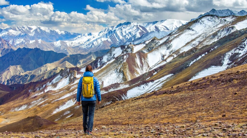
There is a version of Nepal that most trekkers never see. Not because it’s inaccessible or technically beyond reach, but because it requires something the teahouse circuit doesn’t — preparation, self-sufficiency, and a willingness to walk for days without seeing another foreigner, without a menu on a laminated card, without a lodge with a charging […]

-
 Adventure Master Trek
-
12 June, 2026
-
21 mins read
-
212 Views
-
0 Comments
There is a version of Nepal that most trekkers never see. Not because it’s inaccessible or technically beyond reach, but because it requires something the teahouse circuit doesn’t — preparation, self-sufficiency, and a willingness to walk for days without seeing another foreigner, without a menu on a laminated card, without a lodge with a charging port and a wifi password written on the wall.
These are the routes where the trail sometimes disappears into the grass and you navigate by ridge line. Where the only people you encounter are herders moving yaks between seasonal pastures, or a villager who looks at you with genuine curiosity because not many people come this way. Where your tent is your hotel, your stove is your kitchen, and the silence at night is so complete that you can hear the glacier moving.
This is Nepal’s other trekking world. It’s harder to get into. It’s harder to be in. And it stays with you longer than anything you’ll walk on a teahouse route
Before You Read Further — What This Style of Trekking Actually Requires
This is not a guide for beginners. Every route listed here requires you to carry a tent, sleeping bag, cooking equipment, and multiple days of food. There are no lodges. In many places there are no villages. In some stretches there is no trail in the conventional sense — just a direction, a watershed, and your judgment.
You need to be comfortable with the following before attempting any of these routes: multi-day camping in sub-zero temperatures, navigation with a map and compass or GPS without phone signal, river crossings without bridges, self-treatment of blisters, altitude headaches, and minor injuries, and the psychological weight of genuine isolation. If something goes wrong on one of these routes, help is not thirty minutes away. It may be three days away.
If you have those skills, or you’re building them deliberately and pairing with an experienced local guide for your first entry into this world, then read on. These trails are among the most extraordinary wilderness experiences available anywhere on the planet.
1. The Dolpo Region — The Most Remote Inhabited Landscape in Nepal
Location: Far west Nepal, north of Dhaulagiri Duration: 18 to 28 days for a full traverse Maximum Altitude: 5,360 meters at Kagmara La and multiple other high passes Difficulty: Extreme — remote, high, weather-dependent, requires full camping Permit: Restricted Area Permit required — $500 USD for 10 days in Upper Dolpo, $10 per day in Lower Dolpo Best Season: June to October
Dolpo is where Nepal becomes another world entirely. It sits north of the main Himalayan chain, tucked behind the Dhaulagiri massif in a landscape that receives almost no monsoon rain. The terrain is high Tibetan plateau — vast, wind-scoured, ochre and brown and grey, with a sky that seems wider than anywhere else because there is nothing between you and the horizon for enormous distances. The villages here — Dunai, Tarakot, Ringmo, Saldang — are among the most isolated permanently inhabited settlements in Asia. Some have road access now, barely, along tracks that wash out seasonally. Most are still reached primarily on foot.
Ringmo village sits beside Phoksundo Lake, which is one of the most startlingly beautiful bodies of water you will ever stand beside. It is a deep, impossible blue — almost turquoise — fed by glacial meltwater filtered through limestone. The lake sits at 3,611 meters in a bowl of mountains, and the waterfall at its southern end drops into a gorge below the village. There is a small national park guesthouse at Ringmo, but outside of this one point of minimal infrastructure, Dolpo has essentially nothing in the way of trekking facilities.
The full Dolpo traverse — entering from Juphal in the east, crossing into Upper Dolpo, traversing toward Saldang and beyond toward Mugu or exiting back via different passes — requires you to be completely self-sufficient in food and shelter for stretches of five to eight days between any form of resupply. You will carry everything. A fully loaded pack in Dolpo is typically between 18 and 25 kilograms for a solo trekker without a porter. With a porter — and in Dolpo, a local Dolpa porter who knows the terrain is not a luxury but a genuine safety asset — that weight is distributed and your pace becomes more sustainable.
The passes are serious. Kagmara La at 5,115 meters requires crampons in any season with snow, which is most of them. The trails on both approaches are steep, loose, and in places indistinct. The altitude at the top is enough to make every movement feel like it costs twice what it should.
What you get in return is a landscape and a culture that almost no one from the outside world has walked through. The Bon religion — an ancient Tibetan spiritual tradition that predates Buddhism and in some ways absorbed it — is still practiced in Dolpo. The festivals, the monasteries, the daily rituals of the people here have been shaped by isolation into something that is genuinely distinct from anything else in Nepal. You are not a tourist attraction in Dolpo. You are a curiosity, occasionally an inconvenience, and if you behave well, eventually a guest.
Peter Matthiessen wrote about Dolpo in The Snow Leopard, which remains the single best piece of writing about this region. Read it before you go.
What to bring: Full camping kit, minimum seven days food per leg between resupply points, detailed topographic maps, satellite communication device, water filtration, altitude medication, and a local guide who speaks Dolpali and knows the passes.
2. The Kanjiroba Himal Circuit — Barely Mapped, Almost Never Walked
Location: Karnali zone, far west Nepal, surrounding the Kanjiroba massif Duration: 18 to 24 days Maximum Altitude: Over 5,000 meters on multiple passes Difficulty: Extreme — route-finding required, full camping, very remote Best Season: September to October Permit: Shey Phoksundo National Park permit
The Kanjiroba Himal is a cluster of peaks reaching above 6,800 meters that almost no one has heard of outside of specialist mountaineering circles. The circuit around this massif is one of the least-walked high-altitude routes in the entire Himalayan region. There is no established trail for most of it. There is no signage. There are no teahouses, no fixed camps, no infrastructure of any kind. What exists is a series of high valleys, seasonal herder paths, and passes that local herders have used for generations to move animals between grazing grounds.
Completing this circuit requires serious expedition-level navigation skills. You will spend significant stretches of each day looking at the terrain ahead of you and the map in your hand and making decisions about where to go based on what both are telling you. When the two don’t agree — and they often won’t, because the maps of this region are imprecise — you rely on terrain reading, which is the ability to understand where water flows, where the slopes are angled correctly for a pass crossing, where a valley dead-ends versus where it opens onto a col that will take you over.
Villages in the surrounding lowlands — Gamgadhi, Rara Lake area, the Mugu Karnali valley — are places to resupply before entering the high circuit. Rara Lake, Nepal’s largest lake, is nearby and has its own modest trekking infrastructure, but the Kanjiroba circuit itself takes you away from that into a country where resupply is not possible mid-route.
This is a route for people who have already done multiple serious wilderness treks and want something that has not been done by thousands of people before them. The first-ascent feeling of a route like this is real. You are not following a path that exists in any guidebook. You are making your own record of how it goes.
3. The Limi Valley — Three Weeks in a Place Almost Nobody Goes
Location: Humla district, far northwest Nepal, bordering Tibet Duration: 18 to 22 days Maximum Altitude: 5,050 meters at Nyalu La pass Difficulty: Very Hard — remote, camping required, altitude significant Best Season: June, September, October Permit: Restricted Area Permit ($50 per day in the restricted zone), Humla district entry
The Limi Valley is a high valley system in the extreme northwest of Nepal, tucked against the Tibetan border. Three villages — Til, Halji, and Jang — sit at the far end of the valley at altitudes between 3,800 and 4,000 meters. They are among the most isolated villages in Nepal. No road reaches them. The nearest airport is at Simikot, a flight from Nepalgunj, and from Simikot it is a walk of multiple days just to reach the valley entrance.
The people of Limi Valley are ethnically Tibetan, and the culture here is essentially unchanged from traditional high Tibetan pastoral life. The main monastery at Halji — Rinchen Ling — is thought to be over 900 years old. Yak caravans are the primary means of transporting goods in and out. Salt trade, which has been the economic foundation of this region for centuries, still happens along the trails into Tibet.
The approach from Simikot to the Limi Valley crosses the Nyalu La pass at 5,050 meters and requires camping above 4,000 meters for several nights. The descent into the valley on the northern side of the pass is steep and in snow for much of the season. Once inside the valley, you move between the three villages and the surrounding high pastures, and then exit via a different route back toward Simikot or continue on toward the Kailash circuit if you have the permits for Tibet.
There is one small lodge in Til village and sometimes basic accommodation in Halji, but the infrastructure is minimal and unreliable. Treat this as a camping route and anything else is a bonus.
The silence in Limi is a specific kind of silence. It’s the silence of a place where the world outside hasn’t arrived yet. There are no poles with electrical cables. There is no engine noise. The sound of the valley is wind, water, dogs, yak bells, and occasionally a child’s voice from somewhere you can’t see. It is the sound of what most of the Himalayas sounded like before the trekking industry found them.
4. The Tsum Valley — Sacred, Hidden, and Barely Touched
Location: Gorkha district, northeast Nepal, against the Tibetan border Duration: 14 to 18 days Maximum Altitude: 4,079 meters at Ngula Dhojhyang Difficulty: Hard — remote, camping recommended above lower villages, culturally sensitive Best Season: March to May, September to November Permit: Tsum Valley Restricted Area Permit ($35 USD per week)
The Tsum Valley was closed to outsiders until 2008. When it opened, it was developed with deliberate restraint — the permit system, the limited visitor numbers, the requirement to go with an agency — to protect a culture that the people of Tsum themselves had worked to preserve through decades of requested closure.
The valley runs northeast from the Budhi Gandaki river into the mountains against Tibet. The landscape transitions from subtropical terracing at the valley entrance through dense rhododendron and bamboo forest — snow leopard territory, genuinely, with recent sightings documented — into the high, open, light-flooded upper valley where the sacred peak of Ganesh Himal and Baudha Himal and the peaks of the border range frame everything you see.
The people of Tsum are Tsumbas, with their own dialect, their own customs, and a form of Tibetan Buddhism that they practice with a seriousness and consistency that has not been diluted by outside contact the way it has been in more tourist-heavy areas. The monasteries — Mu Gompa, Rachen Gompa, and others — are active religious institutions, not museums. You are a visitor in a place of practice, and the correct posture is respectful and quiet.
There is minimal teahouse infrastructure in the lower part of the valley. In the upper valley, there is essentially nothing. Camping is the only option for anyone going beyond the village of Chhokangparo. You will need to carry all supplies for the upper section.
One practical reality of the Tsum Valley: the trail in the lower section follows the Budhi Gandaki gorge, which involves significant amounts of climbing up and down the canyon walls, crossing log bridges over a fast and cold river, and navigating through sections that feel more like scrambling than walking. It is not technically difficult, but it is physically demanding in a way that accumulates over several days. Your ankles will know about it by the end.
5. The Nar Phu Valley — Beyond the Annapurna Circuit, Into True Isolation
Location: Manang district, north Nepal, just north of the Annapurna Circuit Duration: 7 to 12 days as a standalone, or combined with the Annapurna Circuit Maximum Altitude: 5,190 meters at Kang La pass Difficulty: Hard — remote, camping recommended, high pass Best Season: March to May, October to November Permit: Nar Phu Restricted Area Permit ($90 for the first week)
Nar and Phu are two small villages tucked into a side valley just north of the main Annapurna Circuit trail. They sit at the end of a valley that branches off the circuit at Koto — a branch that most trekkers walk straight past because there is no sign advertising what’s up there and it doesn’t appear on the standard maps sold in Pokhara.
What’s up there is two of the most intact traditional Tibetan-influenced villages in Nepal. Phu village sits at 4,080 meters at the end of a valley that closes off into a wall of glaciated peaks along the Tibetan border. The village feels like it has been placed there deliberately to be found only by people willing to walk far enough to deserve it. The houses are stacked up the hillside in the traditional style, whitewashed and low, with flat roofs stacked with firewood and prayer flags strung between them. The monastery above the village has murals that haven’t been photographed or catalogued. The fields below it grow barley at an altitude where almost nothing else will.
Nar village is a day’s walk below Phu, slightly lower in the valley and slightly more connected to the world — there’s a basic lodge here and occasionally a teahouse in Phu during peak season — but still deeply quiet by any normal trekking standard.
The exit from Nar Phu via the Kang La pass at 5,190 meters takes you back over the main Himalayan chain and deposits you on the Annapurna Circuit near Ngawal, which gives the route a natural loop structure that works beautifully. The pass crossing involves navigating a glacier on the upper approach and requires crampons and an ice axe in any season with snow on the upper section.
Camping in Nar Phu is better than relying on the minimal lodge infrastructure, particularly if you want to spend time in Phu and the upper valley without being constrained by a lodge owner’s meal schedule.
6. The Kangchenjunga Base Camp Trek — Far East Nepal, Almost No One
Location: Taplejung district, far east Nepal Duration: 18 to 22 days Maximum Altitude: 5,143 meters at Pangpema (North Base Camp) Difficulty: Hard to Very Hard — remote, significant altitude, long approach Best Season: March to May, October to November Permit: Kangchenjunga Conservation Area Permit
Kangchenjunga is the third highest mountain on earth at 8,586 meters. It sits in the extreme far east of Nepal, near the Sikkim border, in a region that sees a fraction of the trekking traffic that Everest and Annapurna receive. Getting there requires a flight to Bhadrapur or a long bus from Kathmandu to Taplejung, followed by multiple days of walking through the lower foothills before the mountains even begin to appear.
The approach from the south passes through cardamom farming country — the terraces smell like the spice when you walk through them, which is one of the stranger and better sensory details of trekking in Nepal — through the villages of Taplejung, Chirwa, and Sekathum, and then climbs steadily into the high forests of the Kangchenjunga Conservation Area. The forest here is exceptionally good. Red panda habitat. Dense rhododendron above 3,000 meters. Himalayan black bears and snow leopards, rarely seen, leaving their marks on the trail.
The upper valley splits — one fork goes to the South Base Camp at Yalung Glacier, the other continues to the North Base Camp at Pangpema. Both are extraordinary. Pangpema in particular, with Kangchenjunga’s north face directly above you and the Yalung Kang and Kangbachen peaks flanking it, is a wall of mountain scale that rivals anything on the Everest route.
The teahouse infrastructure exists in the lower and middle sections of this trail but is thin and unreliable in the upper sections. Above Ghunsa, which is the last village with consistent lodges, you are in camping territory. The number of trekkers who reach Pangpema each year is a small fraction of those who reach Everest Base Camp — which is both the point and the reward.
The trail is long and the approach is tiring. You earn this one over weeks, not days.
7. The Dhaulagiri Circuit — Technical, Wild, and Walked by Almost Nobody
Location: Myagdi district, west Nepal Duration: 14 to 18 days Maximum Altitude: 5,360 meters at French Pass and Dhampus Pass at 5,182 meters Difficulty: Extreme — glacial travel required, full camping, route-finding, serious altitude Best Season: April to May, October Permit: ACAP permit
Dhaulagiri is the seventh highest mountain in the world. The circuit around it is one of the hardest multi-day treks in Nepal and one of the least completed. It is not undiscovered in the way that Kanjiroba is — there are old expedition reports and a few trekking accounts that document the route — but it is walked by a very small number of people each year because it demands a very specific combination of experience, equipment, and judgment.
The key sections that make this different from a standard high-altitude trek are the glacier crossings. The approach to French Pass and the descent via the northeast face of Dhaulagiri involve travel on glacial terrain — crevassed ice, moraine, snowfields — that requires crampons, ice axe, and the knowledge of how to use both correctly. This is not scrambling. This is mountaineering-adjacent. If you have not done roped glacier travel before, you need a local guide who has, or you need to turn back at the glacier’s edge.
The views from French Pass on a clear day are among the most extraordinary mountain perspectives available from any trekked pass anywhere. Dhaulagiri’s south face, Tukuche Peak, Tilicho, Nilgiri — the panorama from that pass includes some of the most dramatic relief on earth.
There is no shelter on the high sections of this circuit. Your camp at the base of the glacier before the pass will be at around 4,800 meters. Nights at that altitude in a tent are genuinely cold — minus twenty Celsius is possible in October — and you will be woken repeatedly by altitude and cold and the sounds of the mountain. This is not camping in a field in the Lake District. Bring the right gear and know how to use it.
8. The Rolwaling Valley and Tashi Lapcha Pass — Sacred, Serious, and Spectacular
Location: Dolakha district, central Nepal, west of the Khumbu Duration: 14 to 18 days Maximum Altitude: 5,755 meters at Tashi Lapcha Pass Difficulty: Extreme — technical glacier crossing, very high altitude, full camping Best Season: October, sometimes May Permit: Gaurishankar Conservation Area Permit
The Rolwaling Valley is the hidden valley that sits between the Everest region to the east and the lowlands to the west. The Sherpas who live here consider it a beyul — a sacred hidden valley in the Tibetan Buddhist tradition, a place of refuge and spiritual significance. The valley is narrow, steep-sided, and dramatically beautiful. Tsho Rolpa, the glacial lake at the valley’s head, is large, perfectly blue, and sits directly beneath the terminal moraine of the Trakarding Glacier. It is also a glacial lake outburst flood risk, which is not a reason to avoid it but is information worth having.
The crossing of Tashi Lapcha Pass at 5,755 meters is a technically demanding route that connects the Rolwaling Valley to the Khumbu — to the Thame valley, specifically, which is the western side of the Everest region. The pass crossing involves serious glacial travel with significant crevasse risk, steep ice, and altitude that puts it well above the summit of many popular high peaks elsewhere in the world. It is non-negotiable to have a rope, crampons, ice axe, and a partner or guide with technical glacier experience for this crossing. Solo ascent of Tashi Lapcha is genuinely dangerous.
The approach through the Rolwaling Valley below the glacier is breathtaking and relatively straightforward. The villages of Na and Beding are the last settlements before the glacier, and they offer very basic accommodation — stone shelters rather than teahouses — for trekkers. Above Na, you are camping on the glacier.
If you complete the crossing and descend to Thame, you arrive in the Khumbu with a story that the Sherpa village people there will find unusual and respectful. Very few people come over the pass. The Sherpas who know the route know it because their ancestors used it for trade and seasonal movement.
Essential Gear for No-Teahouse Trekking in Nepal
Shelter: A four-season tent rated for high wind. In Nepal’s high valleys and on exposed ridges, wind is often more dangerous than cold because of its suddenness and force. A tent that collapses at 3am at 4,500 meters is a survival emergency. Don’t economize on the tent.
Sleeping system: A sleeping bag rated to minus twenty Celsius minimum, with a sleeping mat that has a high R-value. Down sleeping bags are lighter and warmer than synthetic at the same weight but lose insulation when wet. In the monsoon shoulder season, synthetic is worth considering.
Cooking: A canister stove that functions at altitude — some stoves lose efficiency above 4,000 meters because the gas pressure drops in the cold. Bring more fuel than you think you need because you’ll be melting snow for water on the high sections. A lightweight pot, a spoon, and a lighter with a backup are your kitchen.
Water: A filter pump or gravity filter for lower altitudes and a reliable method of treating glacial meltwater at higher elevations. Chemical treatment tablets as a backup. A minimum two-liter carrying capacity.
Navigation: Download offline topographic maps to your phone before departure and keep the phone warm inside your jacket because cold kills batteries fast at altitude. Carry a physical map and compass as backup. Know how to use both.
Communication: A satellite communicator — Garmin InReach or SPOT — is not optional on these routes. It is the device that allows you to call for help from a place where your phone has no signal. The subscription costs are real and worth every cent.
Medical: Diamox for altitude sickness prevention if prescribed, dexamethasone for severe AMS as a descent aid in emergency, analgesics, wound care, blister supplies, antibiotic course in case of infected wound, and electrolyte powder for hydration. Know what each medication does and when to use it before you’re in a situation where you need to make that decision under stress.
On Guides for These Routes
A licensed Nepali guide is required by regulation in some of these areas. But beyond regulation, a local guide on these routes is something different from what a guide means on the Annapurna Circuit. Here you are not hiring someone to show you a path that thousands of people walk. You are hiring someone who knows where the pass actually is when the mist comes down, who can speak to the herders who might be the only people you see for days, who knows which valley ends in cliffs and which one goes through, and who has walked this terrain in conditions that you haven’t and can read the signs of changing weather before you understand what you’re seeing.
The right guide for routes like Dolpo, Kanjiroba, or Limi is not found on a booking website. Ask at the Nepal Tourism Board, talk to trekkers who have done these routes, contact organizations like the Himalayan Rescue Association in Kathmandu. Good local guides for remote routes often don’t advertise. They work by word of mouth and reputation. Finding the right person takes longer and costs more than booking a standard service, and it is one of the best investments you can make on a route where the margin for error is real.
What These Routes Offer That Nothing Else Does
There is a quality of experience available in genuinely remote, untouched mountain landscape that is not available anywhere else, including on the most beautiful teahouse route you have ever walked. It is the quality of earning where you are. Of knowing that what you’re looking at is not something that gets looked at very often. Of going to sleep in a tent at 4,800 meters with no other human being within a day’s walk in any direction and lying there listening to the silence, which at that altitude and in that isolation has a texture and a weight that no description quite captures.
The mountains in these places are the same mountains that are photographed on the Everest Base Camp trek. But they look different when you’re the only one looking at them. They seem to look back.
That’s what these routes are for.
Comments (0)
Write a comment- Before You Read Further — What This Style of Trekking Actually Requires
- 1. The Dolpo Region — The Most Remote Inhabited Landscape in Nepal
- 2. The Kanjiroba Himal Circuit — Barely Mapped, Almost Never Walked
- 3. The Limi Valley — Three Weeks in a Place Almost Nobody Goes
- 4. The Tsum Valley — Sacred, Hidden, and Barely Touched
- 5. The Nar Phu Valley — Beyond the Annapurna Circuit, Into True Isolation
- 6. The Kangchenjunga Base Camp Trek — Far East Nepal, Almost No One
- 7. The Dhaulagiri Circuit — Technical, Wild, and Walked by Almost Nobody
Read the latest Blogs & Insights
Explore our collection of articles and insights to gain in-depth travel knowledge, expert advice, and stay updated on the latest trends and tips.


No comments yet.