


Solo Trek Friendly Trails in Nepal — The Complete Guide for Independent Trekkers
Planning a solo trekking adventure in Nepal? Explore the best solo-friendly trekking routes, current permit regulations, safety tips, accommodation options, and practical advice to help you choose the right Himalayan trail with confidence.
-
 Adventure Master Trek
-
3 July, 2026
-
20 mins read
-
5 Views
-
0 Comments
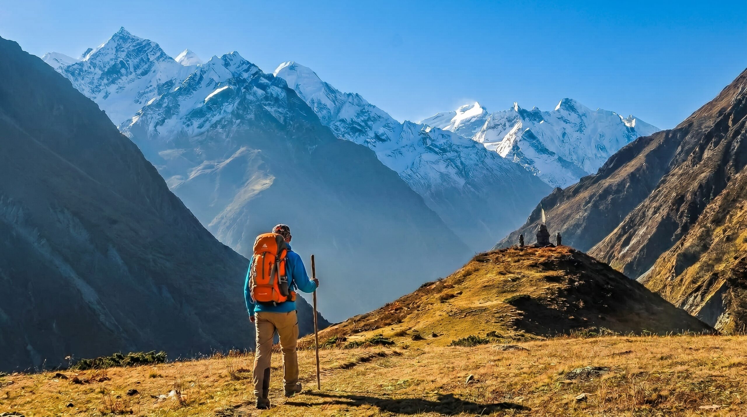
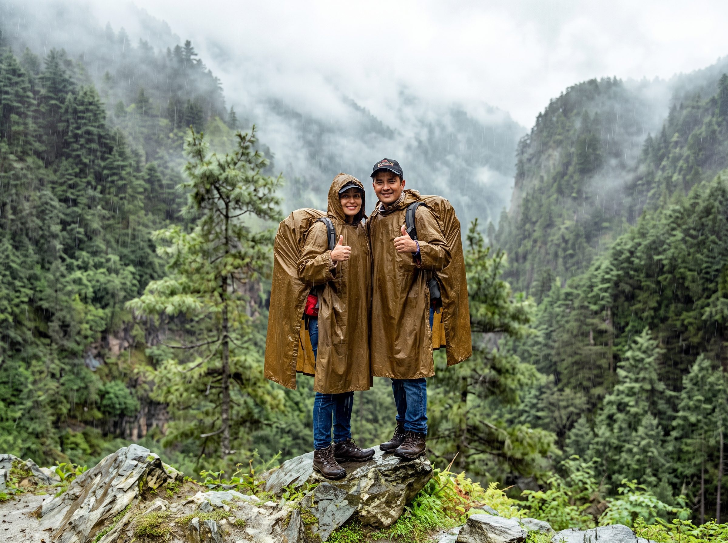
Nepal gets talked about in extremes. People either say it’s the greatest trekking destination on earth, or they warn you it’s too hard, too remote, too bureaucratic to do alone. The truth is somewhere more useful than either of those takes. Nepal has trails that are genuinely well-suited for solo trekkers — routes with enough infrastructure, enough fellow travelers, and enough local support that you can walk them independently, at your own pace, without a guide, without a group, and without anything other than a reasonable level of fitness and some logistical preparation.
This guide covers everything. The trails, the permits, the seasons, the costs, the lodges, the altitude, the gear, and the things nobody puts in the brochure.
First — Can You Actually Trek Solo in Nepal?
Yes, with one major caveat as of recent years. In 2023, Nepal introduced a rule requiring trekkers in certain restricted and high-altitude areas to hire a licensed guide. The Everest and Annapurna regions have largely retained solo freedom for their main routes, but this is worth double-checking before you go because the regulations have shifted and may shift again. For the trails listed in this guide, solo trekking without a mandatory guide is permitted as of current rules — but always verify with the Nepal Tourism Board before you book flights.
What you don’t need for most trails: a guide, a porter, a group, or a trekking agency. What you do need: a TIMS card, the relevant national park or conservation area permit, and enough sense to turn around when the weather tells you to.

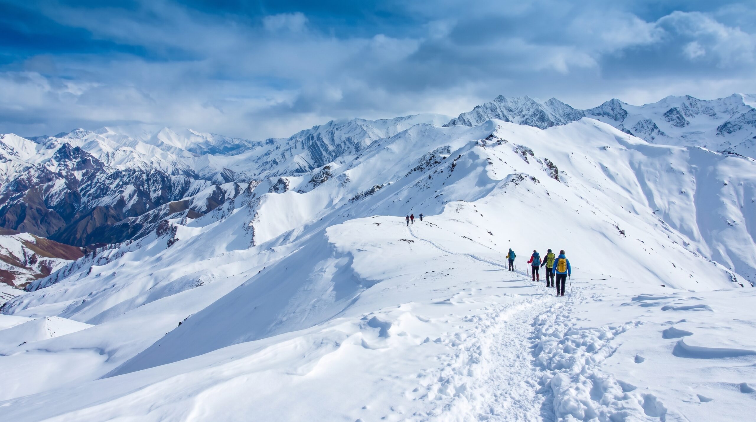
1. The Annapurna Circuit — The Gold Standard for Solo Trekkers
- Distance: 160 to 230 kilometers depending on your route variations
- Duration: 12 to 21 days
- Maximum Altitude: 5,416 meters at Thorong La Pass
- Difficulty: Moderate to Strenuous
- Best Season: March to May, October to November
The Annapurna Circuit is the trail that built Nepal’s trekking reputation. It circumnavigates the entire Annapurna massif, taking you through subtropical lowlands, river gorges, pine forests, high alpine meadows, and finally over Thorong La — one of the highest trekked passes in the world. The route is almost entirely covered by teahouses, which means you don’t need a tent, a sleeping bag rated for extreme cold, or a stove. You show up, you eat, you sleep, you walk.
What makes it ideal for solo trekkers is the density of infrastructure combined with the fact that the trail is well-marked and heavily walked. You will not be alone on this trail. At any given teahouse you’ll meet Israeli gap-year travelers, retired Europeans, young Australians, solo women from Japan and South Korea, and veteran trekkers doing their third or fourth Himalayan route. The social life, if you want it, is entirely available. The solitude, if you prefer that, is also available — you just have to start walking a little earlier or later than the crowd.
The circuit has changed significantly over the past decade. Road construction has eaten into sections of the traditional route, particularly around the lower Marsyangdi valley and toward Manang. This means some trekkers now jeep or bus past the less scenic lower sections and join the trail higher up. That’s a legitimate choice and it shortens the trip without missing the best parts. The upper section — from Manang to Thorong La to Muktinath — is what most people come for, and it remains completely on foot.
Thorong La itself deserves specific mention. The pass crossing is typically done very early in the morning — most trekkers leave between 3am and 5am — to avoid the afternoon winds that can make the descent from the pass genuinely dangerous. The ascent from the tea house at High Camp takes four to six hours. The altitude at the top is real. People turn back every single day. The correct approach is to acclimatize properly in Manang for at least two full rest days before attempting the pass, and to be honest with yourself about how you’re feeling. No view from the top is worth a helicopter evacuation.
Permits needed: ACAP (Annapurna Conservation Area Permit) and TIMS card. Both obtained in Kathmandu or Pokhara.
Approximate daily cost in teahouses: 2,000 to 4,000 Nepali rupees for bed and meals, more at higher elevations.
2. The Annapurna Base Camp Trek — Shorter, Stunning, and Very Solo-Friendly
- Distance: 110 to 115 kilometers round trip
- Duration: 7 to 12 days
- Maximum Altitude: 4,130 meters
- Difficulty: Moderate
- Best Season: March to May, October to November, and possible in winter with preparation
If the full circuit feels like too much time or too much altitude, the Annapurna Base Camp trek — also called the Annapurna Sanctuary trek — is one of the most rewarding shorter routes in Nepal. You walk into a glacial amphitheater completely surrounded by peaks above 7,000 meters. Annapurna I, Machapuchare, Hiunchuli, Gangapurna — they form a 360-degree wall of ice and rock around the base camp clearing. On a clear morning, it is one of the most visually overwhelming places you will ever stand.
The route begins from Nayapul, accessible by jeep or bus from Pokhara, and follows the Modi Khola river valley upward through rhododendron forests — which in March and April are in full bloom and turn the whole hillside red and pink — through the villages of Ghandruk, Chomrong, and Dovan, and then into the upper sanctuary. The trail narrows as you go higher and the vegetation disappears, replaced by moraines and snow.
The teahouse network on this trail is excellent right up to base camp. Chomrong is a particularly good overnight stop — it sits on a dramatic ridge with views of Annapurna South and Hiunchuli and has a solid selection of lodges with reliable food. Stock up on snacks here because the prices go up significantly above this point.
One thing to be aware of: the trail through the Modi Khola gorge and into the sanctuary is one of the most avalanche-prone stretches in the Annapurna region. The park authority sometimes closes it after heavy snowfall. This is not an exaggeration for drama — it is a real closure that happens regularly in winter and after unseasonal storms. Check conditions before you go in and listen to what local lodge owners tell you. They are not trying to make you pay for another night. They are telling you something you need to hear.
Permits needed: ACAP and TIMS card.
3. The Everest Base Camp Trek — The Most Famous Walk in the World
- Distance: Approximately 130 kilometers round trip from Lukla
- Duration: 12 to 16 days
- Maximum Altitude: 5,364 meters at Everest Base Camp, or 5,545 meters at Kala Patthar
- Difficulty: Moderate to Strenuous (the altitude is the challenge, not the technical terrain)
- Best Season: March to May, October to November
Everything you’ve heard about this trek is true and also incomplete. Yes, it’s crowded during peak season. Yes, the teahouses are well-developed and the trail is clear. Yes, the airport at Lukla is famously dramatic — a short tilted runway cut into the side of a mountain with a sheer drop at one end and a cliff at the other. And yes, the views of Ama Dablam, Lhotse, Nuptse, and ultimately Everest itself are exactly as extraordinary as every photograph suggests.
But what most accounts underplay is the cumulative physical experience of the altitude. EBC sits at 5,364 meters. Kala Patthar, the viewpoint most people include, is5,545 meters. You walk there over twelve to sixteen days, which gives your body time to adjust — but the adjustment is never complete. Above Namche Bazaar, which sits at3,440 meters, almost everyone feels something. Headaches, disrupted sleep, reduced appetite, and unusual fatigue are normal. What is not normal, and requires immediate descent, is confusion, loss of coordination, a wet cough, or pressure in the chest. These are signs of serious altitude illness. Know them before you go.
The acclimatization days built into the standard itinerary are not optional. Namche Bazaar and Dingboche both require you to rest for a day and do a shorter high walk before continuing upward. The rule is simple and non-negotiable: climb high, sleep low. Every extra day you take on the way up is a day you protect your safety and your ability to actually complete the trek.
For solo trekkers specifically — the EBC trail is one of the most sociable routes you’ll walk anywhere in the world. The teahouse culture is genuinely communal. Dinner at a lodge means sitting at long tables with whoever else showed up that day, sharing stories and comparing blisters and arguing about the best dal bhat. The trail itself, particularly between Lukla and Namche, can feel almost like a parade during October. Above Dingboche it thins out, and above Lobuche it gets very quiet and very serious.
Permits needed: Sagarmatha National Park permit and TIMS card. Both available in Kathmandu or at the Monjo checkpoint on the trail.
Gear note: Bring a sleeping bag rated to at least minus fifteen degrees Celsius. Teahouse blankets exist but they are not sufficient above Dingboche in cold weather.
4. The Langtang Valley Trek — Underrated, Close to Kathmandu, Deeply Moving
- Distance: 65 to 75 kilometers round trip
- Duration: 7 to 10 days
- Maximum Altitude: 4,984 meters at Tserko Ri
- Difficulty: Moderate
- Best Season: March to May, October to November
Langtang is Nepal’s most underrated major trek, and it has been ever since the 2015 earthquake. A massive avalanche triggered by the earthquake destroyed much of Langtang village and killed over 300 people — villagers, lodge owners, trekkers — in a matter of seconds. The rebuilt village is smaller and quieter than it was before. The memorials are still there. The people who stayed and rebuilt have done something remarkable.
Trekking Langtang now is an act of both adventure and support. The trail has recovered. The lodges are open. The landscape is extraordinary — the valley is flanked by Langtang Lirung, Ganesh Himal, and the peaks of the Tibetan border, and the approach through the lower forests is some of the most beautiful walking in Nepal. Yak herding is still active in the upper valley, and the cheese produced up here — thick, strong, and made in the traditional Tamang style — is legitimately one of the best things you’ll eat on any trek in Nepal.
The access is the other major advantage. Langtang is about seven hours from Kathmandu by jeep. You don’t need a flight. You don’t need days of bus travel. You leave the city in the morning and you’re walking into the mountains by afternoon. For solo trekkers on a tighter schedule or budget, this is a significant practical plus.
Tserko Ri, the high point of the main route, requires a pre-dawn start and rewards you with a panoramic view of the Langtang range and, on a clear day, deep into Tibet. It’s a tough ascent but technically straightforward. Poles help significantly on the descent.
Permits needed: Langtang National Park permit and TIMS card.
5. The Ghorepani Poon Hill Trek — Best for First-Timers and Short Trips
- Distance: 40 to 50 kilometers
- Duration: 4 to 5 days
- Maximum Altitude: 3,210 meters at Poon Hill
- Difficulty: Easy to Moderate
- Best Season: March to May for rhododendrons, October to November for clarity, also possible in winter
If you have limited time, limited trekking experience, or you want to test how your body handles altitude before committing to something longer, Poon Hill is where you start. It’s short enough to complete in a long weekend, accessible enough that you don’t need serious gear, and the payoff — sunrise from Poon Hill over the Dhaulagiri and Annapurna ranges — is one of those views that makes people immediately start planning to come back for longer.
The route goes from Nayapul through the large traditional Gurung village of Ghandruk, up through thick rhododendron forest to Ghorepani, then up the final ridge to Poon Hill for sunrise, and back down a different way through Tadapani. The entire thing is on well-maintained stone steps and dirt paths. You sleep in comfortable teahouses. There are good food options the whole way. Mobile data works in most places. This is, by any definition, gentle trekking.
But gentle doesn’t mean without reward. The Poon Hill sunrise, when the conditions cooperate, shows you Dhaulagiri — the seventh highest mountain in the world — catching the first light and turning from grey to gold to white in about fifteen minutes. Annapurna South and Machapuchare fill the rest of the panorama. If it’s your first time seeing the Himalayas at dawn from a high ridge, it will rearrange something in you regardless of how easy the walk was.
Permits needed: ACAP and TIMS card.
Good to know: This trail is genuinely crowded during peak season. If solitude matters to you, start walking before 6 am to get to Poon Hill before the main crowd arrives.
6. The Mardi Himal Trek — The Hidden Trail Above Pokhara
- Distance: 50 to 60 kilometers
- Duration: 5 to 7 days
- Maximum Altitude: 4,500 meters at Mardi Himal High Camp
- Difficulty: Moderate
- Best Season: March to May, October to November
Mardi Himal sits right next to the Annapurna Base Camp route geographically, but almost nobody does it. It was only officially opened as a trekking route in 2012 and it still doesn’t appear in most mainstream travel guides. This means that while hundreds of people are clogging the path to Annapurna Base Camp on any given October day, you can be an hour away on a ridge with almost no one else around, looking at the same peaks from a different and arguably more dramatic angle.
The trail goes through the forest village of Dhampus, climbs through rhododendron and oak forest to the Low Camp and Forest Camp, then breaks out above the treeline onto an exposed ridge with direct views of Machapuchare — the sacred, never-summited Fish Tail peak — and Annapurna I. The high camp sits on a narrow rocky ridge and the views are unobstructed in every direction.
The teahouse infrastructure here is thinner than on the main Annapurna routes. The lodges are smaller, the menus are simpler, and you should carry some backup snacks and a reliable water purification method. But this is exactly what makes it feel like something you discovered rather than something you were processed through.
Permits needed: ACAP and TIMS card.
7. The Upper Mustang Trek — Permits, Isolation, and a Different Nepal Entirely
- Distance: 100 to 115 kilometers
- Duration: 10 to 14 days
- Maximum Altitude: Around 4,000 meters
- Difficulty: Moderate (lower altitude than most Himalayan treks)
- Best Season: May to October — one of the few treks open during monsoon because it sits in a rain shadow
Upper Mustang is behind a restricted area permit, which costs$500 USD for ten days and $50 per day after that. This is not a budget option. But it is categorically different from every other trek on this list, and the permit price is part of what keeps it different.
Mustang is a former Tibetan kingdom. It wasn’t fully open to trekkers until 1992. The culture, the architecture, the religion, and the landscape are more Tibetan than Nepali — walled medieval villages, cave monasteries carved into cliff faces, mani walls and chortens lining the trails, people who still speak a dialect of Tibetan and practice Tibetan Buddhism in its older forms. The landscape is high desert — eroded canyon walls in red and ochre and brown, minimal vegetation, enormous sky. It looks nothing like the green and white Nepal of the postcard images.
Lo Manthang, the ancient walled capital of the old kingdom, is a genuinely remarkable place. The king’s palace still stands. The monasteries contain murals that are centuries old. The town has electricity now and a few basic guesthouses, but it retains a physical character that most of the trekking world hasn’t reached yet.
This trek does require a registered agency and guide by regulation, so it technically doesn’t fit the fully independent category — but it’s worth including because it’s one of the most distinct experiences available to a solo traveler, and you can book it as a solo client with an agency and still be effectively on your own experience.
Permits needed: Restricted Area Permit ($500 for 10 days), ACAP, and TIMS card.
8. The Tamang Heritage Trail — Culture-First Trekking Near Kathmandu
- Distance: 90 to 110 kilometers
- Duration: 8 to 10 days
- Maximum Altitude: Approximately 3,850 meters
- Difficulty: Easy to Moderate
- Best Season: October to May
The Tamang Heritage Trail is for trekkers who want cultural immersion alongside the mountain scenery. The trail runs through a cluster of traditional Tamang villages in the Langtang region — communities that had very little contact with tourism until the trail was formally developed in the mid-2000s. The Tamang people have their own language, their own Buddhist traditions distinct from Sherpa culture, their own textile and architectural styles, and a genuine everyday life that the trail takes you through rather than past.
You’ll sleep in homestays and small local lodges. The food is home-cooked. You’ll walk through villages where the men are returning from the fields and the women are weaving by their doorways and the children are running between the chortens. None of this is performed for trekkers. It’s just what’s happening, and you happen to be walking through it.
The trail connects with Langtang at its upper end, so an ambitious trekker can combine the Tamang Heritage Trail with the Langtang Valley trek for a two-week loop that covers both cultural depth and high mountain scenery.
Permits needed: Langtang National Park permit and TIMS card.
Permits — Everything You Need to Know
There are two main permits that cover the majority of solo trekking in Nepal.
The TIMS Card — Trekkers Information Management System — is required for almost all routes. It comes in two versions: a green card for independent trekkers and a blue card for agency-organized trekkers. The green card costs more. Get it at the Nepal Tourism Board office in Kathmandu’s Pradarshani Marg or at the Trekking Agencies Association of Nepal office. Bring passport photos and a photocopy of your passport ID page.
The conservation area or national park permit depends on where you’re going. Annapurna requires the ACAP permit. Everest requires the Sagarmatha National Park permit. Langtang requires the Langtang National Park permit. These are checked at entry points to the relevant areas. They are not optional. Rangers do check them, and trekkers caught without them are fined and occasionally turned back.
Best Seasons Broken Down
October and November are the most popular months for a reason. Post-monsoon skies are extraordinarily clear, temperatures are manageable at altitude, and the trails are in good condition. The downside is crowds on popular routes, particularly EBC and Annapurna Base Camp.
March and April and May are the second peak season. Lower trails are full of blooming rhododendrons. The weather is warmer and more variable than autumn, and there’s more chance of afternoon cloud build-up obscuring views. May in particular can bring pre-monsoon instability. But it’s also when the high passes open up and the upper routes become accessible again after winter.
December, January, and February are cold and quiet. Many high-altitude teahouses close. The trails see very few trekkers. The low-altitude routes — Poon Hill, the Tamang Heritage Trail, parts of the Annapurna foothills — are actually lovely in winter if you’re equipped. The Everest and Annapurna high routes are harsh but doable for experienced trekkers who know what they’re getting into.
June, July, August, and September are monsoon. Most routes are wet, leech-ridden, and frequently cloud-covered. Upper Mustang is the notable exception, sitting in the rain shadow behind the Dhaulagiri-Annapurna barrier and getting very little monsoon rain.
Teahouse Culture — What to Actually Expect
The teahouse system is the backbone of solo trekking in Nepal. A teahouse is a combined lodge and restaurant, almost always family-run, where you pay a small amount for a basic room — usually a twin or single with thin walls, a mattress, and a pillow — and a somewhat larger amount for your meals. The unwritten rule across most of the Himalayan teahouse network is that rooms are cheap or sometimes even free on the expectation that you’ll eat your meals at that lodge. Don’t eat elsewhere and sleep there — it’s bad form and the lodges depend on that income.
Dal bhat is the default meal everywhere and it is the correct meal to order. Two portions of rice, a lentil soup, a vegetable curry, a small salad and pickle, and sometimes an egg or meat side. It is nutritionally complete, calorie-dense, warming, and usually includes unlimited refills of the dal and rice. At altitude and after a full day of walking, it is exactly what your body needs. Many experienced trekkers eat it twice a day for the entire trip. The trekking menu items — pasta, pizza, sandwiches, apple pie — are available everywhere and are universally worse and more expensive than the dal bhat. Order the dal bhat.
Hot water for washing is available at most teahouses for a small fee. Electricity for charging devices is also usually available for a fee, and the fee increases as you go higher. Above Namche on the EBC route, you’re paying significantly more per charge because everything runs on solar and the capacity is limited. Bring a power bank and charge it at lower elevations before you need it.
Safety and Solo Trekking
Register your trek with your embassy before you go. It takes five minutes and means someone knows your general itinerary. Many embassies have online forms for this.
Tell teahouse owners your plan each morning. This is not bureaucratic. These are the people who will notice if you don’t show up and will alert the right people if something goes wrong.
Download offline maps before you leave mobile network coverage. Maps.me and Gaia GPS both have Nepal trail data. Download them in Kathmandu or Pokhara.
Know the symptoms of altitude sickness cold. Mild AMS — headache, fatigue, mild nausea — is normal and managed by rest and hydration and not going higher. HACE (brain swelling) and HAPE (fluid in the lungs) are emergencies that require immediate descent and potentially evacuation. The symptoms to watch: confusion, loss of coordination, inability to walk a straight line, persistent cough producing pink or frothy sputum, inability to catch your breath at rest. If any of these appear, the only treatment is to go down, immediately, regardless of how close you are to your destination.
Carry travel insurance that explicitly covers helicopter evacuation at altitude. Read the policy. Some general travel policies exclude high-altitude trekking. You need one that doesn’t, because an evacuation from above 5,000 meters costs several thousand US dollars minimum.
What to Pack — The Honest List
Boots that are already broken in. This is non-negotiable. Blisters from new boots at altitude are miserable and can end a trek. Wear your boots on day hikes at home for weeks before you go.
Trekking poles. Many people resist these. Most of them change their mind on the first steep descent. Your knees will thank you on day eight.
A down jacket. Bring one that’s genuinely warm, not a fashion down jacket. Above 4,000 meters, evenings are cold enough that a cheap packable jacket won’t do the job.
Merino wool base layers. They dry quickly, don’t smell after repeated wearing, and regulate temperature better than synthetic in variable mountain conditions.
A headlamp with fresh batteries, and backup batteries. Power outages happen. Early morning starts are standard. The headlamp is not optional.
Water purification. Iodine tablets or a SteriPen or a filter bottle. Don’t buy plastic water bottles at altitude — the cost is absurd, the environmental damage is real, and the alternatives work perfectly.
A basic first aid kit including blister supplies, ibuprofen for headaches, rehydration salts, and diamox if your doctor has prescribed it as a preventive for altitude sickness.
Sunscreen rated 50 or higher. The UV intensity at altitude is drastically higher than at sea level. Sunburn at Kala Patthar or Thorong La is not a minor inconvenience — it is immediate and severe.
Final Note
Nepal rewards trekkers who go in prepared and stay honest with themselves on the trail. The mountains don’t adjust to your schedule or your ambitions. The itinerary is always negotiable. The altitude isn’t. Go slow, eat the dal bhat, watch the weather, talk to the people you meet, and let the trail take longer than you planned.
It almost always does. That’s mostly where the best parts happen.
Comments (0)
Write a comment- First — Can You Actually Trek Solo in Nepal?
- 1. The Annapurna Circuit — The Gold Standard for Solo Trekkers
- 2. The Annapurna Base Camp Trek — Shorter, Stunning, and Very Solo-Friendly
- 3. The Everest Base Camp Trek — The Most Famous Walk in the World
- 4. The Langtang Valley Trek — Underrated, Close to Kathmandu, Deeply Moving
- 5. The Ghorepani Poon Hill Trek — Best for First-Timers and Short Trips
- 6. The Mardi Himal Trek — The Hidden Trail Above Pokhara
- 7. The Upper Mustang Trek — Permits, Isolation, and a Different Nepal Entirely
- 8. The Tamang Heritage Trail — Culture-First Trekking Near Kathmandu
- Permits — Everything You Need to Know
- Best Seasons Broken Down
- Teahouse Culture — What to Actually Expect
- Safety and Solo Trekking
- What to Pack — The Honest List
- Final Note
Read the latest Blogs & Insights
Explore our collection of articles and insights to gain in-depth travel knowledge, expert advice, and stay updated on the latest trends and tips.


No comments yet.